
Updated on 03/12/2024
Dear readers
My name is Frank and I run a tour operator in Bogota, specializing in custom-made and Colombia luxury travel.
At the end of this guide you will find a useful Colombia travel guide.
Content
Why visit Inírida?
The municipality of Inírida, also known as “Puerto Obando”, is the capital of the department of Guainía.
The municipality borders to the east with the village of Cacahual and the Republic of Venezuela, to the south with the villages of Puerto Colombia and Sejal, to the north with the inspections of Arrecifal and Sapuara, and to the west with the villages of Morichal and Banco Minas.
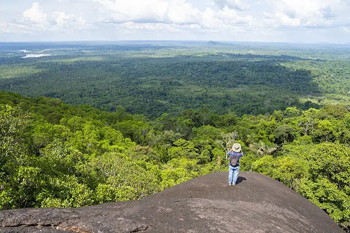
Inírida is a great destination because there are places with lots of nature where you can see a great variety of animals and also admire some very beautiful sunsets.
Facts about Inírida
- Inírida is located at an altitude of 95 meters above sea level.
- Inírida is the most populated municipality in the department of Guainía.
- Inírida has a warm climate with temperatures between 20°C and 30°C.
- The main industries of Inírida are agriculture, mining and fishing.
- Inírida was named after the princess Inírida, who according to legend is imprisoned in the Mavicure Mountains due to a lovesickness.
- Inírida is the youngest capital of the entire Colombian Amazon.
- Inírida has a population of approximately 32,000 inhabitants.
- Inírida was founded on August 5, 1974.
- Inírida has an area of 17,000 square kilometers.
Tourist attractions in Inírida
In the following we present some of the most important sights of the municipality:
Monumento de la Princesa Inírida
The monument to Princess Inírida is located in the Zona Indígena neighborhood, one of the first neighborhoods to emerge in the municipality.
If you decide to visit this place, you can enjoy this iconic 2.5m high monument and a park with fitness equipment, a micro soccer field and a basketball court.
Museum of the Municipality of Guainía
The Guainía Community Museum is located on 26th Street and 9th Street.
This museum houses many historical pieces of the ethnic groups that have inhabited the area over the years.
Parish of Nuestra Señora del Carmen
The Parroquia Nuestra Señora del Carmen is located at Calle 15 # 6-50.
This church is attended by all parishioners living in Inírida.
Municipality of Coco Viejo
In the municipality of Coco Viejo there are numerous rock carvings of pre-Columbian origin and clay crafts made by the indigenous people of the area.
Yuruparí Cultural Maloca
The Maloca Cultural Yuruparí is an ethnographic museum with an extensive documentation of the cultures of the indigenous people of Guainía.
Here you will find traditional costumes, oddly shaped stones and tools for hunting and fishing.
Tourist attractions near Inírida
Here are some attractions near Inírida.
Remanso and the hills of Mavicure
Remanso and the hills of Mavicure are one of the most visited places by tourists in the department of Guainía. They are 31 miles south of Inírida.
In this place, inhabited by the native Puinaves, you will have the opportunity to practice various water sports, go hiking and bird watching.
If you decide to visit this place you can enjoy the hills of Mavicure and also the Inírida River, which is home to different species of fish such as palometas, agujones, cuchas, guaracus and rays.
The famous film “The Embrace of the Snake” was filmed in this iconic location.
The Witch’s Lagoon
Laguna de la Bruja is a 10-minute boat ride from Inírida.
In this lagoon you can listen to the sounds of the wild animals of the jungle and also watch the Toninas, also known as “The Pink Dolphins of the Amazon”.
In the Laguna de la Bruja you also have the opportunity to go water skiing.
Guainía Natural and Cultural Park
The Natural and Cultural Park of Guainía is located at km 11 of the Berrocal Vitina road.
In this park you can see a wide variety of carnivorous plants and centenary trees.
You can also go hiking and bird watching.
Estrella Fluvial del Sur
The Estrella Fluvial del Sur is located on the Colombia-Venezuelan border, 20 miles from Inírida.
Named after the German scientist Alexander Von Humbolt, this place is formed by the confluence of the Atabapo, Orinoco and Guaviare rivers.
Flower Garden of Inírida
The flower garden of Inírida is located 20 minutes by car from the center of the municipality, on the road to Caño Vitina.
In this place, recognized as a natural cultural heritage, there are different types of flowers that are part of a protection program by the environmental authorities, among which the Inírida flower, a red flower resembling an ear of corn, stands out.
Cano Vitina
The Caño Vitina is a river that has a red tint due to a substance expelled by the trees that surround it.
Best time to visit Inírida
The best time to visit Inírida is between December and February, when the weather conditions are more favorable to visit and enjoy the city’s various tourist attractions.
In February, there is also the summer festival, one of the most important events in the municipality that takes place throughout the year.
Events not to be missed in Inírida
Here are the main events that take place in Inírida throughout the year and not to be missed.
Arts and Culture Festival
The Arts and Culture Festival is an event that aims to showcase the talents of local artists so they can find new opportunities in the industry.
This festival takes place in October.
Summer festival
The Summer Festival takes place in February, usually on the beaches of the Inírida River.
During this festival, which aims to promote tourism in the Guainía department, various competitions are held such as volleyball, beach soccer, observation races, triathlon and also a beauty contest.
Inírida’s birthday
The founding of the city is celebrated on August 5 of each year. Various artistic performances take place on this day.
Feast of the Colonies
The Colonies Festival, also known as “Three Cultures Encounter”, is an event that celebrates the work of the different colonies in the department.
The Colonies Festival takes place in the month of November.
Nightlife in Inírida
Inírida has a few places where you can listen to music and dance, here are some of them.
Nexus nightclub
City center
https://www.facebook.com/nexusNightClubInirida/
Nexus Night Club hosts various events and shows where you can sing, drink and dance.
El Marquez
Calle 15 # 2-22
https://www.facebook.com/ElMarquezVip/
This bar is known for its warm atmosphere and attentive staff.
Here you will find alcoholic and non-alcoholic beverages to accompany your meetings with friends and family.
El Marquez also has one of the best karaoke bars in town.
EL BAR
Calle 26c # 25-67
https://www.facebook.com/elbarinirida/
EL BAR offers a wide range of food and alcoholic beverages.
Typical dishes in Inírida
These are some of the typical dishes that you can find in the municipality of Inírida.
Ajicero
Ajicero is a dish made with fish flakes, chili peppers and salt.
Chicha de Pijiguao
Chicha de pijiguao is a drink made with pijiguao, sugar and flour.
Moquiao
Moquiao is a dish made with fish, banana leaves, lemon and salt.
Casajillo
Casajillo is made with cassava arepa, garlic powder, butter and salt to taste.
Accommodation in Inírida
Here are some of the available accommodations in Inírida, Colombia:
Hotel Cabana Guainiana
Calle 16 # 15-67
CLICK HERE TO GET BEST RATES FOR HOTEL CABAÑA GUAINIANA
Hotel Cabaña Guainiana offers its guests different areas such as a garden, a shared lounge and a restaurant.
The rooms have air conditioning, a desk, a safe, an oven, a flat screen TV, a private bathroom with a shower and a terrace.
Located 1,2 miles from César Gaviria Trujillo Airport, Hotel Cabaña Guainiana also offers free bikes, laundry services and an airport shuttle.
Hotel Tucunare
Calle 15 # 2-06
CLICK HERE TO GET THE BEST RATES FOR THE HOTEL TUCUNARE
Hotel Tucunaré has a terrace, shared lounge, restaurant and bar.
The rooms are equipped with private bathroom, air conditioning, flat screen TV and in some cases even a balcony.
Hotel Tucunaré is 1,8 miles from César Gaviria Trujillo Airport.
Hotel Toninas
Calle 16 # 5-112
CLICK HERE TO GET THE BEST RATES AT THE TONINAS HOTEL
Toninas Hotel features a garden, shared lounge, restaurant and bar.
The rooms feature a refrigerator, private bathroom, flat-screen TV and desk.
Hotel Toninas is 1,2 miles from César Gaviria Trujillo Airport.
How to get to Inírida?
The municipality of Inírida is located 688 kilometers from Bogotá, the capital of Colombia. There are several ways to get from Bogotá to Inírida.
By plane
The quickest way to get to Inírida is by plane. César Gaviria Trujillo Airport, formerly known as Obando Airport, is connected to Bogotá and Villavicencio. This airport is located on the outskirts of Inírida.
You can travel with the airline Satena.
The airlines that offer connections are as follows:
By car
To get to Inírida from Bogotá by car, one has to drive to San José del Guaviare and then take a ferry boat to Inírida as there are no inland roads.
The trip to San José del Guaviare takes 8 hours and then the boat can take several days to bring the car to Inírida.
Colombia Travel Guides
Here you will find travel guides for the most popular regions in Colombia, which we have put together during our extensive travels around the country.
- Colombia Travel Guide
- Bogota Colombia Travel Guide
- Medellin Colombia Travel Guide
- Cartagena Colombia Travel Guide
- Santa Marta Colombia Travel Guide
- Cali Colombia Travel Guide
- Coffee Triangle Colombia Travel Guide
- Barranquilla Colombia Travel Guide
- La Guajira Colombia Travel Guide
- Tayrona Park Colombia Travel Guide
- Palomino Colombia Travel Guide
- San Andres Island Colombia Travel Guide
- Providencia Island Colombia Travel Guide
- Casanare Llanos Colombia Travel Guide
- Amazonas Colombia Travel Guide
- Chocó Colombia Travel Guide
- Santander Colombia Travel Guide
- Boyaca Colombia Travel Guide
Travel Guides to Colombia’s Small Towns
Here you will find travel guides for less popular destinations in Colombia. Some of these destinations are even real insider tips and not even known to the Colombians as travel destinations.
- Aguachica Colombia Travel Guide
- Arauca Colombia Travel Guide
- Armenia Colombia Travel Guide
- Barrancabermeja Colombia Travel Guide
- Bucaramanga Colombia Travel Guide
- Buenaventura Colombia Travel Guide
- Canyon Chicamocha Colombia Travel Guide
- El Carmen de Bolivar Colombia Travel Guide
- Caucasia Colombia Travel Guide
- Cucuta Colombia Travel Guide
- Florencia Colombia Travel Guide
- Ibagué Colombia Travel Guide
- Inirida Colombia Travel Guide
- Ipiales Colombia Travel Guide
- Magangue Colombia Travel Guide
- Manizales Colombia Travel Guide
- Mitu Colombia Travel Guide
- Mocoa Colombia Travel Guide
- Monteria Colombia Travel Guide
- Neiva Colombia Travel Guide
- Palmira Colombia Travel Guide
- Pasto Colombia Travel Guide
- Pereira Colombia Travel Guide
- Popayan Colombia Travel Guide
- Puerto Asis Colombia Travel Guide
- Puerto Carreno Colombia Travel Guide
- Quibdo Colombia Travel Guide
- Riohacha Colombia Travel Guide
- San José del Guaviare Colombia Travel Guide
- Sincelejo Colombia Travel Guide
- Sogamoso Colombia Travel Guide
- Tulua Colombia Travel Guide
- Tumaco Colombia Travel Guide
- Tunja Colombia Travel Guide
- Turbo Colombia Travel Guide
- Valledupar Colombia Travel Guide
- Villa de Leyva Colombia Travel Guide
- Villavicencio Colombia Travel Guide
- Yopal Colombia Travel Guide
