
Updated on 04/30/2024
Dear reader,
I would also like to recommend our Colombia travel guide, which provides a perfect overview of the tourist attractions in Colombia. Enjoy reading it!
Content
Hiking in Colombia
Are you a fan of adventure, scouting for your next thrill? Let me tell you why Colombia should be on your radar, especially if hiking trails are your thing:
- A hidden paradise: Believe it or not, Colombia is a treasure trove for hiking enthusiasts. With its 3 Cordilleras and other mountains, it offers landscapes and hiking routes ranging from easy to extremely challenging terrain.
- Not just mountains: If mountains aren’t your thing, in Colombia, you can explore the lower lands: the Llanos, the Amazon, and the Caribbean coast. There’s something for everyone!
- Ideal climate: Situated right on the geographic equator, Colombia enjoys stable temperatures all year round. Warmth in the lowlands and cooler temperatures as you ascend.
- Highest peaks: Colombia’s highest peak is in the Sierra Nevada de Santa Marta, towering over 5,700 meters (18,700 feet) above sea level. From lowlands to snow-capped peaks and volcanoes, Colombia has it all.
I’ll share with you the most incredible regions for hiking and the specific routes you shouldn’t miss. But first, here’s a breakdown explaining the difficulty levels you’ll encounter on each route:
- Moderate: The terrain is flat, paved, or cobblestoned, clearly marked, not too lengthy, and doesn’t require much physical effort. Suitable for all ages.
- Intermediate: Mostly uncovered terrain, with slopes, humidity, and mud. The length requires considerable physical effort. Not suitable for those with mobility issues.
- Difficult: Mostly uncovered terrain, with steep slopes, pronounced ascents, uncertain weather conditions, and great physical condition is required. The route is usually long. Not suitable for elderly adults, individuals with heart or respiratory issues, children under 8, or women with high-risk pregnancies.
Hiking and walking routes in Bogotá
Bogotá is the political and economic capital of Colombia. It is a huge city with a catastrophic traffic system. Bogota is located at over 2,600 meters (8,500 feet) above sea level and there are many hiking opportunities inside and outside the city.
Also check out my blog with the most complete travel guide to Bogotá.
 Rio Arzobispo
Schedule: 8:00 a.m. – 4:30 p.m.
Difficulty Level: Moderate.
Distance: 4.86 km.
Route Type: Round trip.
Duration: 3 and a half hours.
Access: Free.
Temperature: 15 – 21 °C
Weather: Cold.
Starting Point: Just after crossing the Circunvalar above the National Park, you’ll find the beginning of the trail. Near the entrance, don’t miss the artworks and unique installations. Also, it’s close to water treatment plants, serving as orientation points.
- Going alone or accompanied?: The municipality offers guided tours, but if you prefer going alone, you’ll see many locals trekking, often with their dogs.
- Safety First: Although it’s an amazing spot, there have been reports of thefts. It’s important to research safety thoroughly before setting out on your journey.
La Chorrera
Schedule: 8:00 a.m. – 5:30 p.m.
Difficulty Level: Difficult.
Distance: 9 km.
Route Type: Round trip.
Duration: 5 hours.
Access: Paid.
Altitude: 2,500 – 3,300 meters (8,202 – 10,827 feet)
Temperatures: 13 – 19 °C
Weather: Mild.
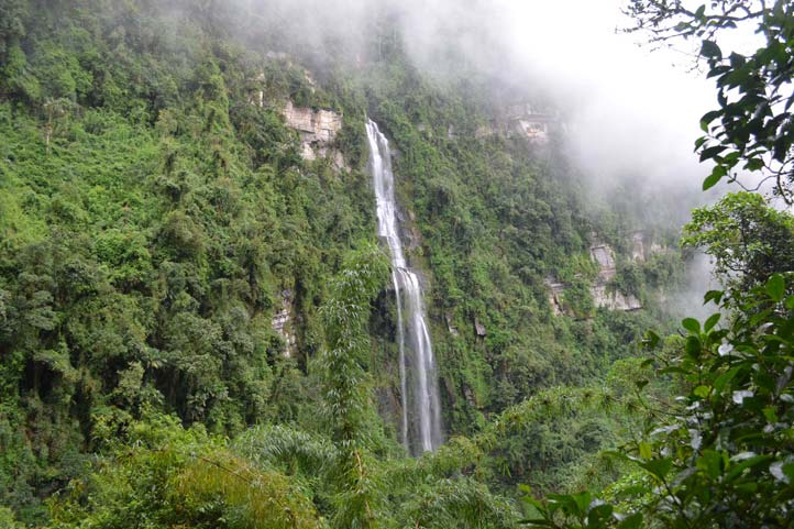
La Chorrera is a natural waterfall with a 590-meter free fall and is the tallest waterfall in Colombia.
- How to get there?: It’s just an hour’s drive from Bogotá. Though you can take a bus, be prepared to walk an hour from where it drops you off to the entrance. Pro tip: consider private transport for more convenience.
- The adventure is worth every step: Get ready for a route that goes up and up, but the views and experience are unparalleled.
Two key stops:
- First station: Less than an hour’s walk, you’ll reach the base of the waterfall. Here’s a natural “pool” perfect for a dip if you dare to brave the cold.
- Second station: After another hour of hiking, you’ll reach a spectacular lookout overlooking the waterfall. If it’s not the dry season, get ready to feel the mist on your face!
Extras to enjoy:
- Behind the waterfall: Yes, you can walk behind it for a unique experience.
- Cool off: The natural pool is ideal for adventurers looking to cool off.
- Eat and drink: There are food and beverage options to recharge.
- I recommend wearing good hiking shoes.
Cerro de Monserrate
Schedule: 6:00 a.m. – 10:00 a.m. and 11:00 a.m. – 1:00 p.m.
Difficulty Level: Difficult.
Distance: 3.44 km.
Route Type: One way.
Duration: 45 minutes.
Access: Free on foot
Altitude: 3,152 meters (10,350 feet) above sea level.
Temperature: 19 – 29 °C
Weather: Cold – Mild.
Monserrate Hill is Bogotá’s local and most popular mountain, where you’ll find a church with a panoramic view of the city. It’s a place with a lot of history and significance for locals.
- Ascend routes: Monserrate can be climbed by funicular, cable car, or on foot, the classic route for many Bogotans, athletes, and religious individuals. Climbing the stairs gives you that authentic city vibe.
- Length and steps: Get ready for a 2,350-meter (7,700-foot) path with 1,605 steps, ending at 3,150 meters (10,350 feet), mastering a 450-meter altitude (1,475 feet). Yes, it’s quite demanding!
- My experience: Being an average athlete, my last climbing time was 45 minutes.
- Days to avoid: If possible, avoid Sundays and holidays. It gets quite crowded, and the experience may not be as peaceful as you’d like.
Important:
- Do not consume food during the ascent. At the top, you’ll find places for breakfast or lunch.
- Wear comfortable clothes and appropriate footwear.
- Use sunscreen.
- Stay hydrated during the journey, maintaining distance.
- Keep to your right for ascending and descending.
- No pets allowed.
Purchase your tickets from the official website.
Quebrada La Vieja
Schedule:
- Tuesday to Friday: 6:00 a.m. – 11:00 a.m.
- Weekends: 6:00 a.m. – 12:00 p.m.
Difficulty Level: Moderate.
Distance: 5.5 km.
Route Type: One way.
Duration: 3 hours.
Access: Free, but you must register first on the Acueducto’s website.
Altitude: 2700 – 3,300 meters (8,858 – 10,827 feet) above sea level.
Temperature: 26 – 28 °C
Weather: Cold – Mild.
La Quebrada La Vieja is one of the most famous and popular hiking routes in Bogotá. It is located in the Chapinero locality, in the Eastern Hills.
- Strategic location: Begin your adventure on Circunvalar Avenue, at Calle 70. It’s easy to find, with signage along the way.
- Views + nature: Get ready for breathtaking views of Bogotá, surrounded by pure nature. Imagine small streams where you can bathe and thousands of trees accompanying you on the journey.
- Perfect for everyone: Whether alone, with your family, friends, or your partner, it’s a route for all kinds of people, the ideal escape to disconnect and enjoy in the company of whoever you want.
- Don’t miss out: Make sure to reach the lookout of the cross. From there, the views of the Colombian capital are simply spectacular.
Important:
- Walk only on established and marked trails.
- Stay in a group throughout the entire journey.
- Carry hydration with you at all times.
- Do not consume food while walking, especially during ascents, to avoid airway issues.
- No pets allowed.
You can visit this link for reservations and more information on guided tours.
Laguna de Guatavita
Schedule: 8:00 a.m. – 5:00 p.m.
Difficulty Levels: Moderate – Intermediate.
Size: 400 meters in diameter / 1,352,633 square feet.
Access: Paid.
Altitude: 3,100 meters (10,171 feet) above sea level.
Temperature: 11°C
Weather: Cold.
The Guatavita Lagoon is a historically significant cultural and spiritual site, as the Muisca, an ancient indigenous tribe, conducted rituals to choose their leaders. It truly is a sacred place!
- Where is it located? The Guatavita Cacique Lagoon is a body of water located in the eastern range of Colombia, on Tierra Negra Road in the municipality of Sesquilé in Cundinamarca.
- Calm route: Although not a hiking trail in the classic sense, you’ll enjoy a pleasant walk along a natural path. Perfect for nature lovers who prefer gentler walks.
- Lagoon views: The trails surrounding the lagoon offer spectacular Andean landscapes.
- Flexible return options: After soaking in all the beauty and tranquility of the place, you can return to the entrance by vehicle or on foot.
Important: Pets are not allowed. Wear comfortable sportswear for cold weather and make sure to bring your first aid kit.
If you’re interested, you can visit the official website for more information.
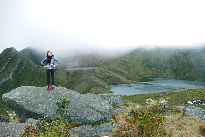
Laguna La Siecha
Schedule: 8:00 a.m. – 5:00 p.m.
Difficulty Level: Difficult.
Duration: 5 hours.
Distance: 7.4 km.
Access: Paid.
Altitude: 3,400 – 3,760 meters (11,155 – 12,336 feet) above sea level.
Temperature: 6 – 12 °C
Weather: Cold.
These are three lagoons that are part of the Chingaza National Park, but they have a separate entrance and the journey from Bogotá takes approximately 2 hours.
- The adventure begins here: Upon arrival, you’re greeted with an introductory video. Perfect for getting into the mood and understanding the magic of the place.
- Prepare for the terrain: The path to the three lagoons is an uphill climb that challenges you with its steep, wet, and soft terrain. Golden advice: wear rubber boots or waterproof hiking shoes. Believe me, you’ll need them.
- Impressive altitude: You’ll ascend to over 3,600 meters above sea level (11,810 feet). Yes, you’ll be walking among the moors, a unique ecosystem.
- Surprise visits: I’ve been there a couple of times, and let me tell you, each visit is a new adventure. You can have a day with stunning clear views or one where the fog envelops you in spectacular mystery.
To access the lagoon, you must do so through the Chingaza National Natural Park.
Chingaza National Natural Park
Schedule: 8:00 a.m. – 5:00 p.m.
Difficulty Levels: Moderate – Intermediate – Difficult.
Area: 766 km² / 8,245,155,907 square feet.
Access: Paid.
Altitude: 800 – 4,000 meters (2,625 – 13,123 feet) above sea level.
Temperatures: 4 – 21 °C
Weather: Cold.
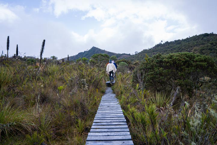
Chingaza National Natural Park is a natural reserve near Bogotá that harbors incredible species like frailejones and the spectacled bear. Surprisingly, not many people pay it a visit. This place is a natural paradise ideal for hiking enthusiasts.
Explore your way:
- Multiple entrances and routes: Choose your adventure with the wide range of types of trails and routes that the park offers, from the easiest to the most demanding ones.
- Camp under the stars: If you enjoy the full adventure and appreciate nature as your backdrop, you can camp here.
- Mountain climate: Prepare for cold and humid moor weather, and don’t be surprised if you’re enveloped in mist.
Unique experience:
- Global Big Day 2018: Two colleagues and I stayed near Chingaza Lagoon. The next day, we headed towards Villavicencio, descending about 3,500 meters (11,500 feet) in altitude. We recorded 120 bird species along the way!
Important: You should bring plastic boots, sunscreen, comfortable cold-weather clothing, preferably waterproof.
Schedule your visits through the Chingaza National Natural Park.
Hiking and walking routes in Boyacá
Do you fancy yourself an outdoor adventure enthusiast? Then Boyacá, just north of Bogotá, is your next destination. Let me tell you why:
- A paradise active people: Boyacá is a dream spot for hiking and cycling enthusiasts. There are even tours where you can horseback ride from Bogotá to Yopal in the Llanos, passing through Boyacá. Imagine that journey!
- Colossal mountains: Here, you’ll encounter peaks that will take your breath away and landscapes reminiscent of the pre-Alps.
- Must-visit destinations: Villa de Leyva, Monguí, and the Sierra Nevada del Cocuy are the region’s top tourist spots.
- Culture and tradition: Besides nature, Boyacá is famous for its Christmas lights in December and its colonial towns brimming with history, ancient churches, and squares that transport you through time.
I also wrote an interesting blog with the best Boyacá travel guide you will find.
Iguaque Flora and Fauna Sanctuary
Schedule: Monday to Friday 8:00 a.m. to 12:00 p.m. and 2:00 p.m. to 5:30 p.m.
Difficulty Level: Difficult.
Distance: 9.2 km.
Type of Route: Round trip.
Duration: 6 to 7 hours.
Access: Paid.
Altitude: 2,840 – 3,829 meters (9,318 – 12,562 feet)
Temperature: 4-12°C
Climate: Cold.
The Iguaque Flora and Fauna Sanctuary is a natural reserve consisting of 6,750 hectares of moor and Andean forest in the charming Villa de Leyva. It’s highly recommended for hiking.
- Unmissable destination: Iguaque lagoon is a gem within this natural reserve, perfect for trekking enthusiasts seeking to connect with nature.
- Be prepared for the weather: At this altitude, you’ll be in the moors, where the climate can be quite humid and cold. So, remember:
- Wear sturdy hiking shoes.
- Don’t forget your rain protection; you’ll thank me later!
- What you gain: The views and the experience of walking to Iguaque lagoon are truly rewarding. Although the ascent can take between 6 and 7 hours, I assure you every step is worth it.
Schedule your visit through the official website.
Las Cárcavas
Difficulty Level: Moderate.
Distance: 9.2 km.
Type of Route: One way only.
Duration: 3 hours.
Access: Free.
Altitude: 2,155 – 3,608 meters (7,070 – 11,837 feet)
Temperature: 14 – 23°C
Climate: Cold.
Las Cárcavas of Villa de Leyva is a hidden treasure nestled among the mountains of Boyacá department. Here’s what you need to know:
- Starting point: The journey begins right at the old market square of Villa de Leyva and takes you to a spectacular lookout in Sáchica.
- The trail: Get ready for a path of earth and yellow stone, adorned with impressive laminar rock walls.
- Equip yourself well: Make sure to wear shoes with good grip, especially during the rainy season, and protect yourself from the sun.
- What you’ll see: Along the way, you’ll enjoy wonderful views towards Villa de Leyva and encounter typical vegetation of desert areas, like agaves.
- A break along the way: Halfway through the route, there’s a house selling beverages. You don’t need a specific point to find it; just follow the trail!
Ocetá Moorland and Black Lagoon
Difficulty Levels: Intermediate – Difficult.
Distance: 10.03 km.
Type of Route: Round trip.
Duration: 5 hours.
Access: Free.
Altitude: 3,021 – 4,000 meters (9,911 – 13,123 feet)
Temperature: 0 – 17°C
Climate: Cold.
If you’re looking to explore one of Boyacá’s most spectacular, yet lesser-known, places, Ocetá Moorland is calling you. It’s near Monguí, a Colombian heritage town. Here’s the essentials to get you excited to discover it:
- Why visit? Known as the most beautiful moorland in the world, Ocetá awaits you with postcard-worthy landscapes.
- Inauguration: This route was opened in 2019, after two years of construction.
- Route: The path takes you straight to the heart of the moorlands, passing through the mystical and sacred Black Lagoon, believed to be home to protective spirits and deities.
- Dreamlike landscapes: From frailejones to Senecios and lupines, the moorland vegetation here is unique. Also, don’t miss the lateral glacial moraines, evidence of the ice and snow that once reached 3,500 meters above sea level.
- Important: It’s advisable to bring protection for cold and rain, warm and waterproof clothing, sunscreen, and proper hydration.
El Cocuy National Natural Park
Schedule:
- Park entrance: 5:30 a.m. – 8:00 a.m.
- Laguna Grande and Lagunillas -Púlpito Trails: 6:00 a.m. to 8:00 a.m.
- (Ritacuba Trail) and the glacier edge descent schedule will be maximum at 1:00 p.m.
Difficulty Levels: Intermediate – Difficult.
Access: Paid.
Altitude: 3,000 – 5,330 meters (9,843 – 17,487 feet)
Temperature: 4 – 11°C
Climate: Temperate – cold.
El Cocuy National Natural Park is one of Colombia’s most important natural parks, founded in 1977. It’s a true marvel offering experiences for nature and adventure lovers. The peaks of this mountain range rise to over 5,300 meters (17,400 feet) above sea level. Here’s what you need to know:
- Extent: It stretches across Boyacá, Arauca, and Casanare, so you’ll encounter varied landscapes and ecosystems.
- Indigenous population: The territory is home to the Uw’a indigenous community, guardians of this sacred land.
- Current access: Although the park had to partially close in 2017 due to negative impacts of tourism, today, there’s good news. Three one-day trekking routes are open: Pulpit Lagoons Trail, Grande de la Sierra Lagoon, and Ritacuba Trail.
- Plan your visit: It’s crucial to get information from their official website before your visit to know the current situation and available routes.
Important:
- Arrive in the area one day or more before the ascent so you can acclimatize to the altitude and avoid altitude sickness or soroche, which can even cause death.
- Only travel on authorized trails, always accompanied by a guide.
- Carry out any trash you generate during your visit and take it out when you leave the protected area, including biodegradable waste.
- Pets are not allowed in the protected area.
- Wear sports clothing, also waterproof and boots.
Hiking and walking routes in the Coffee Triangle
The Coffee Triangle is a spectacular region, globally renowned for its coffee and majestic mountain landscapes.
Primarily composed of the departments of Caldas, Risaralda, Quindío, and a part of Tolima, this place is the heart of coffee production in Colombia.
- Central and Western Andes: The area lies between these two mountain ranges, creating a natural environment perfect for coffee cultivation. To the west lies the Pacific coast.
Hiking Routes:
- A paradise for hikers: Here you’ll find countless hiking trails, with many of them leading through authentic coffee farms.
- Golden advice: The best way to explore is by asking at each place you visit. Locals always have the best tips and recommendations for you.
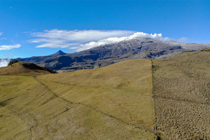
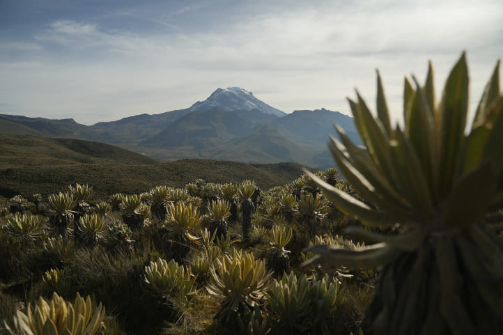
Nevado del Ruiz
Los Nevados National Natural Park Schedule
Both Nevado del Ruiz and Nevado del Tolima are located in Los Nevados National Natural Park.
North Zone
Induction Center – Tumbas Valley: 8:00 a.m. – 2:00 p.m.
Central Zone
- Laguna Verde Trail: 8:00 a.m. – 2:00 p.m.
- Potosí – La Asomadera: 7:30 a.m. – 12:00 p.m. For unequipped hikes, extended until 2:00 p.m.
- Potosí – Otún Lagoon: 7:00 a.m. – 12:00 p.m.
South Zone
- Route from Truchera to La Argentina-Buenos Aires, La Primavera, and La Playa: Entrance 6:00 a.m. to 10:00 a.m.
- Juntas Route: From Perlas stream to El Salto School or Cañón Hot Springs, 6:00 a.m. to 10:00 a.m.
- Anzoátegui Route: Starts at Finca la Aurora towards Vancouver Farm or Cañón Hot Springs, 6:00 a.m. to 11:00 a.m.
Difficulty Levels: Intermediate – Difficult.
Access: Paid.
Altitude: 5,321 meters (17,457 feet) above sea level
Temperature: 4 – 6°C
Climate: Cold.
Nevado del Ruiz is a stratovolcano. There are various types of volcanoes, but this one, in particular, has a conical shape and great height, with its summit covered in glaciers. Located in the Tolima department, it is the northernmost active volcano in the Andes.
Feeling up for an adventure to Nevado del Ruiz? Here’s how to make it happen:
- Getting there: From Manizales, it’s about a 1-hour and 30-minute bus ride. Simply head to the bus terminal and take the Manizales – La Esperanza route. They’ll guide you on where to stay.
- Tailored tours: You can choose between day tours for a quick getaway or opt for a multi-day experience in Los Nevados National Park, the entity responsible for managing the area.
- Check before venturing: Keep in mind that this volcano is active, and due to its regular seismic activity, the park and hiking routes are not always available. It’s always best to inquire in advance to avoid surprises.
Nevado del Tolima
Difficulty Levels: Intermediate – Difficult.
Access: Paid.
Altitude: 1,400 – 5,276 meters (4,593 – 17,125 feet) above sea level
Temperature: 4 – 6°C.
Climate: Cold.
Nevado del Tolima is a volcano located in the Central Range of the Andes in Colombia.
- Starting point: You can reach it via Ibagué or Anzoátegui in Tolima.
- The hot springs: In a way, it’s the base camp, where expeditions from Ibagué and Anzoátegui get ready to attempt the summit.
What you need for the climb:
- Professional equipment: It’s not just any hike; you’ll need specialized gear for climbing.
- Expert guide: An experienced guide is essential for this journey. Safety first.
- Prepare for the cold: Snow and ice await you up there, so bundle up.
Looking for something less demanding?
- Combeima Canyon: If you prefer to avoid multi-day tours, Combeima Canyon is an excellent alternative. Here, you can enjoy more leisurely hikes with stunning views without straying too far from Ibagué.
- Access and adventure: This area is not only easily accessible but also offers charming destinations to explore.
- Keep in mind: After heavy rains, the valley has been known to become isolated, so check the weather before your adventure.
Recommendations for visiting the snow-capped mountains
- Stay well hydrated before, during, and after the ascent.
- Use dark sunglasses with high UV protection.
- Use high-quality sunscreen.
- Wear appropriate clothing and footwear to retain heat and protect yourself from moisture.
- Take the necessary time to acclimatize when needed.
- If you don’t feel well, descend immediately.
- If you have cardio-respiratory conditions, DO NOT attempt these routes.
If you want to visit these snow-capped mountains or need more information, visit the official website.
Salamina
Why Visit Salamina?
- Salamina is a small and charming town steeped in tradition and recognized as one of the country’s cultural gems.
- Though it’s a treasure, it remains undiscovered by many tourists. It’s your chance to explore without crowds!
Getting to Salamina:
From Manizales, it’s just a 2-hour drive away, but beware, the road has many curves. However, it’s absolutely worth it!
La Samaria Forest Awaits:
- Just 90 minutes from Salamina, this forest is a natural wonder where you can hike or ride among the wax palms, Colombia’s national trees.
- Valle de Cocora or La Samaria? If you ask me, La Samaria guarantees a more unique and peaceful experience.

Ecoparque Peñas Blancas
Schedule: 8:00 a.m. – 2:00 p.m.
Difficulty Levels: Moderate – Intermediate – Difficult.
Access: Paid.
Altitude: 2,530 meters (8,300 feet) above sea level
Temperature: 14 – 20°C
Climate: Cold – temperate.
EcoParque Peñas Blancas is the most beautiful and peaceful ecological park offered by the municipality of Calarcá in the Coffee Triangle.
- Where’s the action? Right in Calarcá in Quindío, you’ll find this route leading to the summit, situated at an impressive 2,530 meters above sea level.
- First Stop: At the entrance, there’s a restaurant where, besides fueling up, you can pay for park access.
Choose Your Adventure:
- Easy or challenging? After a short ascent, you’ll encounter a fork in the road. If you’re seeking excitement (and a bit of climbing), opt for the difficult path. If you prefer something more leisurely, the easy path is for you, offering panoramic views of Armenia.
- How much time do you need? This adventure is perfect for half a day. I highly recommend it!
- Biking or hiking enthusiast? Plans are underway to open up the entire mountain for cyclists and hikers. While it won’t happen overnight, this project promises to make it an unmissable destination.
For more information, visit the official website and schedule your adventure.
Valle del Cocora
Schedule 8:00 a.m. – 6:00 p.m.
Levels of difficulty: Moderate – Intermediate – Difficult.
Type of route: Round trip, one way.
Access: Paid.
Altitude: 2,400 m.a.s.l. (7,874 feet).
Temperature: 12 and 21 °C.
Climate: Temperate.
What is the Cocora Valley? The iconic Cocora Valley is one of Colombia’s top tourist destinations with the best natural landscapes. I have a couple of quick tips for you:
- Choose your time wisely: For a quieter and more enjoyable experience, try to avoid weekends and holidays.
- Explore further afield: From Salento, you can venture into Tolima through Los Nevados National Park. Here, incredible views of wax palms, the largest on the planet, and other ecosystems also await you. Definitely make the detour to this place – I promise it’s worth it!
Important:
- Bring plenty of hydration and some snacks.
- It is an area where it is usually quite foggy, but it can also be sunny in many sections. So wear a hat and sunscreen.
- Use mosquito repellent.
- It is best to get up early and arrive early. In the afternoon is when the rain usually arrives.
- You can stay in some of the best accommodations in Valle de Cocora that we have chosen for you.
Risaralda
Risaralda is a department of Colombia located in the southwest of Caldas Department.
- Proximity to the Pacific: Not only are there coffee plantations, but you also have the opportunity to explore areas with a unique cultural diversity. From Risaralda, you can head towards Quibdó, the capital of Chocó, located on the Pacific coast. A must-visit destination for nature lovers.
Explore with a local guide:
- Although I don’t have a specific hiking route to recommend, as my experience was with a local guide, I suggest researching Apia and its surroundings if my description has piqued your interest.
- Nevado Santa Isabel and Laguna del Otún: Be sure to visit these two places, both offer breathtaking landscapes and are perfect for trekking and nature lovers.
Hiking and walking routes Putumayo
I have been to Putumayo twice and always far too short. The department used to be a center of guerrillas, but tourism has slowly developed since the peace agreement.
The entire area is very virgin due to the former occupation of the militant groups and nature is largely untouched. There are dozens of waterfalls and many routes, but you should definitely hike with a local guide.
Fin del Mundo
Difficulty Level: Moderate.
Distance: 6 km.
Route Type: One-way.
Duration: 1 hour.
Access: Free. If done through an agency or with a tour guide, there is a cost.
Altitude: 490 – 830 meters above sea level (1,608 – 2,723 feet)
Temperature: 23°C.
Climate: Warm.
The Fin del Mundo Waterfall is the most famous tourist attraction in the Putumayo department. It’s an impressive waterfall that reaches a height of 70 meters.
- Must-visit destination: The region is also known for experiences where tourists try ayahuasca with local indigenous people.
- Route to the waterfall: The ascent to the waterfall takes about an hour. Before reaching it, you can take a dip in the cold water of several natural pools.
- Natural lookout: The waterfall is spectacular, and upon arrival, you’ll be equipped with everything you need for climbing. Once at the top, you can walk to the edge of the waterfall, look down, and enjoy the scenery.
Hiking and walking routes in Popayan
Popayan is the capital of the Cauca department. It is also called the white city and is extremely beautiful. Also, Popayan is a sanctuary for Christians.
The city tour can already be described as a hike since you also climb the nearby hills. However, the real hiking destination is the following.
Explore also our Popayán travel guide blog, this will complement your adventure.
Puracé
Difficulty Levels: Intermediate – Difficult.
Route Types: Round trip.
Access: Paid.
Altitude: 4,646 meters above sea level (15,243 feet)
Temperature: 2 – 15 °C
Climate: Cold.
The Puracé Volcano is a natural gem, located an hour from Popayán. The area is inhabited by indigenous people who also offer hikes along several trails.
- Condor sightings: The area is best known for condor sightings, the largest flying bird on the planet, although there is no guarantee of always seeing them.
- Regulated visits: The indigenous population has limited the number of daily visitors. There are always conflicts with tourist operators in the region, although reaching the summit of the volcano is very much worth it.
You must request the permit directly from the Puracé National Park.
Hiking and walking routes in Nariño
Nariño is also an absolute hiking paradise. The department is located in the south of Colombia and borders on Ecuador. There are countless routes and around 15 volcanoes. The department is truly unique because it borders the Amazon region in the east and the Pacific in the west.
There are 2 areas I would like to highlight below.
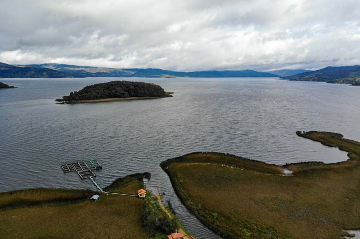
Laguna de la Cocha
Difficulty Level: Intermediate.
Access: Paid.
Altitude: 2,680 meters above sea level (8,793 feet)
Area: 40.5 km² / 435,938,400 square feet.
Temperature: 14 – 25 °C
Climate: Cold.
La Cocha Lagoon is one of the largest reservoirs in the country and is just an hour’s drive from Pasto, the capital of Nariño department.
- Sustainability and natural trails: Around the lagoon, several farmers have begun to conserve natural resources and establish ecological trails. Therefore, you can move along various paths in the area and also find food.
- Small park, great charm: Colombia’s smallest national park is also located at the lagoon. The Sanctuary of Flora La Isla de la Corota can be visited by boat.
Lately, access has been quite controlled due to environmental security issues; however, you should make your request through the official website.
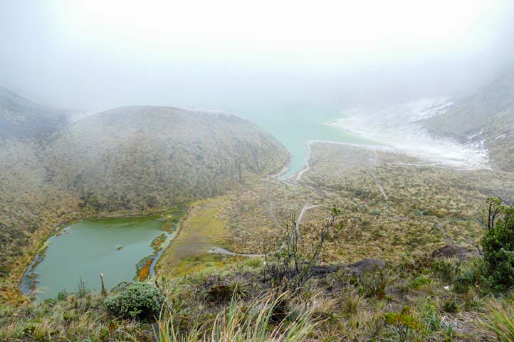
Azufral volcano
Difficulty Level: Intermediate.
Distance: 7.5 km.
Route Type: Round trip.
Duration: 90 minutes.
Access: Free.
Altitude: 3,900 – 4,000 meters (13,100 feet) above sea level.
Temperature: 20 – 27 °C.
Climate: Cold – Temperate.
- Where is it? Approximately a 2-hour drive from Pasto is the Azufral Volcano with the Green Lagoon inside the crater.
- Accessibility: You can drive up quite high, and it took me about 90 minutes to walk from the entrance to the Lagoon. My assistant at the time took another 30 minutes to arrive.
- Some setbacks: The ascent is easy, and the trail is well managed. The view is definitely worth it. However, due to the altitude and weather, visibility can also be poor.
Important:
- The Azufral Volcano is not always open. Mainly due to tourist pollution, the route has been closed intermittently.
- If you’re interested in climbing a volcano, you should inquire in advance. Fortunately, there are alternatives in the area.
- It’s worth noting that the park will be open until further notice, so you should stay updated through the official website.
In case you need lodging, we also have a guide with the best hotels in Nariño.
Hiking and walking routes in Santander
The department of Santander has long been known for outdoor enthusiasts and extreme athletes. With the Chicamocha canyon, 2 kilometers deep and over 50 kilometers (31 miles) long, and San Gil, this region is an absolute reference. The region also has the most beautiful colonial village in Colombia, what a paradise!
Visit our Santander travel guide for more adventures.
Camino Real from Barichara to Guane
Difficulty Level: Moderate.
Distance: 6 km.
Route Type: One way.
Duration: 2 hours, 5 minutes.
Access: Free.
Altitude: 1,019 – 1,334 meters (3,340 – 4,377 feet) above sea level.
Temperature: 20 – 30 °C.
Climate: Hot.
- Ancestral Route: This historic route connects the towns of Barichara and Guane. The indigenous Guane people traversed these paths approximately 6 kilometers (3.7 miles) centuries ago. Today, it is one of Colombia’s most famous routes due to its history and landscapes.
- Stone Path: The royal road is also bordered by a fence made of the same material, but with no other complement than the synchrony that ensures the stones fit and stack on top of each other.
- Practical Tip: Although the climate in the area is very pleasant, I recommend starting the route early because it can get hot, and there is no shade anywhere along the way.
Hiking in the Chicamocha Canyon
Difficulty Levels: Moderate – Intermediate – Difficult.
Access: Free.
Depth: 2,000m.
Extension: 264 hectares / 28,416,725 ft².
Temperature: 25 – 30 °C.
Climate: Hot.
- A Colossal Canyon: The Chicamocha Canyon is the second largest in the world and thus offers countless hiking routes. There are several companies that offer guided tours in the area.
- Highly Versatile Location: Due to the difference in altitude, you experience very different climates. For me, this region is an absolutely key destination in Colombia.
- Lengerke’s Legacy: In the mid-19th century, Geo Von Lengerke, a German, arrived in Colombia, specifically to the Chicamocha Canyon, to rebuild the ancient indigenous and Spanish roads. He used stones to improve these roads, thus facilitating the transit of farmers, traders, which strengthened the trade and economy of the department. Lengerke’s path includes the stretch from Barichara to Guane.
So, you should go see these trails for yourself.
Hiking and walking routes around Santa Marta
As I always and everywhere explain, I am an absolute fan of Santa Marta on the Caribbean coast. The city is small and fine, has a pretty historical core, and is the perfect starting point for various activities. With the Sierra Nevada de Santa Marta, the region also has the highest coastal mountains in the world.
Check out my blog with a 7-day Santa Marta travel itinerary that we created just for you.
Sierra Nevada de Santa Marta
Difficulty Levels: Moderate – Intermediate – Difficult.
Access: Paid.
Altitude: 5,775 meters (18,947 feet) above sea level.
Extension: 172,000 hectares (1,720 km² / 18,513,927,101 ft².)
Temperature: -1 – 23 °C.
Climate: Cold – Temperate.
The Sierra Nevada de Santa Marta is a very famous tourist destination in Colombia, where the wisdom of nature and indigenous knowledge converge.
- Indigenous Communities: Here you will find some indigenous communities such as the Koguis, the Arhuacos, the Wiwas, and the Kankuamo, who still preserve their ancestral customs and are guardians of this place.
- Hiking Routes near Minca: If you are looking for less crowded routes to avoid the tourist crowds visiting Minca, this area offers you several fantastic options.
- Essential Transportation: To venture to higher altitudes, you will need a 4×4 vehicle or an all-terrain motorcycle. It is crucial for moving around with ease and safety.
- Guided Tours: To access special routes in the Sierra Nevada de Santa Marta, it is best to opt for a professional guided tour. Not only is it safer, but it will also enrich your adventure with local knowledge.
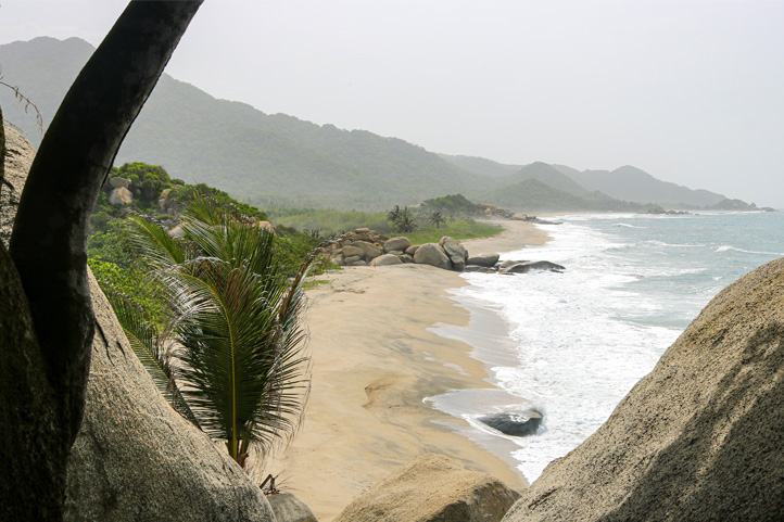
Tayrona Park
Schedule:
- Zaino: entry from 7:00 a.m. to 12:00 p.m. and exit between 2:00 p.m. and 5:00 p.m.
- Calabozo: entry from 7:00 a.m. to 11:00 a.m. and exit between 1:00 p.m. and 3:00 p.m.
- Palagana: entry from 7:00 a.m. to 2:00 p.m. and exit between 4:00 p.m. and 5:00 p.m.
- Bahía Concha: entry from 7:00 a.m. to 2:00 p.m. and exit between 3:00 p.m. and 4:00 p.m.
Difficulty Level: Moderate.
Distance: 12 km.
Route Type: Round trip.
Duration: 2 hours 45 minutes.
Access: Paid.
Altitude: 900 meters (2,953 feet) above sea level.
Temperature: 26 – 38 °C.
Climate: Warm.
Tayrona Park is the most visited national park in the country. It offers beautiful beaches and wildlife-filled environments. Currently, access is quite controlled to avoid overcrowding.
Route to Cabo San Juan:
- The path: From the main entrance, you can walk to Cabo San Juan, passing through several stunning beaches along the way.
- Caution: Some of these beaches have dangerous currents. It’s always best to inquire and take precautions.
Return options:
- By boat to Taganga: From Cabo San Juan, you can return to Taganga by boat in the afternoon. Spaces are limited, so be sure to reserve your spot in advance.
- On foot: If you prefer, you can also leave the park on foot, which is the easiest return option.
- More routes and tours: Tayrona Park offers various routes and guided tours to explore its natural and cultural treasures.
Ciudad Perdida
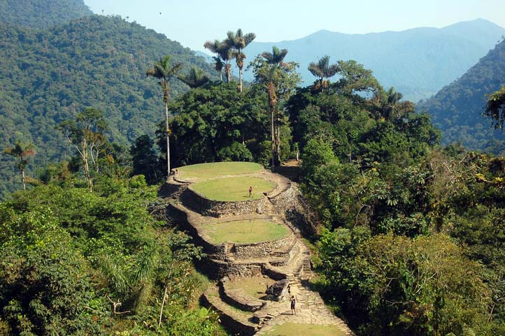
Difficulty Level: Intermediate.
Distance: 50 km.
Route Type: Round trip.
Duration: 4 to 5 days.
Access: Paid.
Altitude: 1200 meters (3,937 feet) above sea level.
Temperature: 29 – 32 °C.
Climate: Warm.
The Ciudad Perdida is an incredible attraction, a mysterious indigenous archaeological complex hidden deep in the Colombian jungle. It’s like the Colombian Machu Picchu.
- The adventure: Essentially, it’s a long journey. Imagine spending 4, 5, or 6 days trekking through the Sierra Nevada de Santa Marta to get there. You can only experience this adventure on a guided tour, in small groups with a local guide.
- Equipment: You’ll need good shoes because the paths can be steep and a bit muddy at times.
- Climatic challenge: For me personally, the distance wasn’t the big challenge, but rather the hot and humid weather. You’re always sweaty from the start.
- Best time: Although trekking to the Ciudad Perdida is open year-round, the best time to do it is between December and March when the dry season occurs and there’s less chance of rain.
If you want more detailed information, you can check out my Santa Marta travel guide.
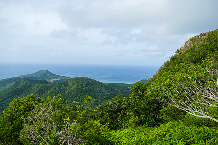
Hiking and walking routes on Providencia
The Peak
Difficulty Level: Moderate.
Distance: 7 km.
Route Type: Round trip (circular).
Duration: 2 hours.
Access: Free, however, you’re not allowed to climb without hiring a local guide.
Altitude: 361 meters (1,184 feet) above sea level.
Temperature: 25 – 30 °C
Climate: Warm.
Providencia is the quintessential dream island of the Colombian Caribbean, near San Andrés.
- The trek: The highest point of the island is on a hill called “The Peak”. You can easily reach it and be at the top in about an hour.
- Caribbean views: The panoramic views from there are breathtaking, allowing you to see not only the various shades of blue of the sea but also the coral reefs around the island.
- Climbing tip: As it can get quite hot on the island during the day, I recommend climbing early in the morning, bringing enough hydration, and of course, tropical climate clothing with comfortable walking shoes.
I also have a blog with more complete information, the Providencia travel guide that you should know.
More nature tourism experiences in Colombia
Here you will find a list of incredible destinations for hiking and other nature activities in Colombia:
- Best 9 Hiking Regions and 27 Routes in Colombia For Travelers
- Colombian Flowers: The Top 11 Most Representative Species
- Cocoa Guide Colombia – Features & Producers
More recommended hiking trails
- Discover the 7 Best Hiking Routes in Antioquia, Colombia
- The 7 Most Incredible Hiking Routes in Boyacá, Colombia
- The 9 Best Hiking Routes in Cundinamarca, Colombia
- Hiking in Santander, Colombia – 5 Incredible Routes
- How to Hike the Lengerke Trail in Colombia: A Complete Guide
- Hiking in Colombia’s Coffee Region: Top 5 Must-Visit Routes
- Must-Try Hiking Trails in Magdalena, Colombia
- Discover 4 Must-Visit Hiking Trails in Amazonas, Colombia
- The 6 Best Hiking Trails in Tolima, Colombia
- Climbing Tolima Volcano: A Challenging Andes Adventure
- 5 Must-Experience Hiking Routes in Huila, Colombia
- 5 Must-Experience Hiking Trails in Valle del Cauca, Colombia
- 6 Must-Experience Hiking Trails in Cauca, Colombia
- Explore 9 Scenic Trails in Eastern Plains, Colombia
- Hiking in Colombia: Checklist of 23 Essential Items to Bring
- The 9 Wild and Adventurous Hiking Routes in the Colombian Andes
- 9 Hiking Routes in Colombia Ideal for Families
