
Updated on 03/13/2024
Dear reader,
I would also like to recommend our Colombia travel guide, which provides a perfect overview of the tourist attractions in Colombia. Enjoy reading it!
Content
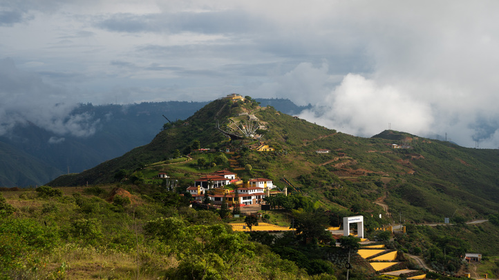
Geographical panorama in Santander, Colombia
The state of Santander is located in the northwest of the country in the Andean region. The capital is Bucaramanga and is located at an altitude of 1,200 meters above sea level. This region of Colombia is crossed by the Oriental Cordillera. However, due to the great geographical diversity in its 87 communities, there are higher or lower communities. In general, the landscapes are hilly, so there are deep gorges, rivers, waterfalls and thermal springs.
Standout sites include the Chicamocha Canyon and the Serranía de los Yariguíes. Santander is known for its tourist offer of adventure activities such as festivals, extreme sports and hiking. It also has a rich natural diversity with about 70 protected areas, including natural parks, reserves and sanctuaries.
Hiking trails in Santander, Colombia
Here is information about the best hiking routes in different municipalities of Santander, Colombia. There are popular routes as well as lesser-known ones. Here is the marking that explains the difficulty level of each route.
Difficulty characteristics
Moderate
The terrain is flat, asphalted or paved and clearly marked. It is not very long and does not require excessive physical exertion. Suitable for the whole family.
Medium
The terrain is mostly uncovered, there is unevenness, moisture and mud. The route requires significant physical exertion and is not suitable for people with reduced mobility.
Difficult
The terrain is largely uncovered, there are steep climbs, uncertain weather conditions and high physical demands. The route is usually long and not suitable for the elderly, those with heart and respiratory diseases, children under 8 years old or pregnant women.
Hiking routes in Aratoca, Santander
Aratoca is a picturesque small town located 45 minutes from Bucaramanga and located at an altitude of 1,600 to 1,800 meters above sea level. It is a popular tourist destination as it retains its colonial architecture and is ideal for nature experiences, extreme sports and hiking. One of the main ecotourism attractions is Chicamocha National Park, located on the road from Bucaramanga to San Gil. The park is home to Chicamocha Canyon, the perfect place for adventure lovers.
Hiking in Chicamocha Canyon
Difficulty level: Moderate. The path is well-marked, there are refreshment points and it is paved, so the hike is easy.
Distance: 1.5 km one way on the Mirador Trail.
Duration: 1 hour.
Altitude: Start point at 1,600 meters, finish at 1,800 meters above sea level.
Climate: Warm and cold depending on altitude.
This famous canyon is the result of erosion by the Chicamocha River and is considered one of the deepest canyons in South America. It ranges from 300 meters to 2,000 meters above sea level, depending on your location on the canyon rim. This place is an ideal place for hiking due to its impressive landscape and numerous hiking trails. Some 0f these routes are:
- Butterfly Trail
- San Vicente Creek Trail
- Treasure Box Trail
- San Gil – Barichara Trail
However, I will elaborate on the Mirador Trail, one of the most visited trails. This route begins in Chicamocha National Park (Panachi) and offers captivating panoramic views of the canyon from a large viewpoint. Along the way, you can enjoy the various cliffs, the Chicamocha River and numerous rock formations. There are good photo opportunities along the way. You may also be able to spot majestic Andean condors, one of Colombia’s important national animals.
Wear comfortable shoes and don’t forget to use sunscreen and insect repellent. Pets are allowed but are not in the water area of Chicamocha National Park.
Opening hours: Wednesday to Friday from 10:00 a.m. to 6:00 p.m., weekends from 9:00 a.m. to 6:00 p.m.
Entrance: With a fee.
Website: https://parquenacionaldechicamocha.com/
Hiking the Camino Real from Barichara to Guane
Difficulty level: Moderate. This is not a demanding route as it is mainly downhill, and paved. An early start is recommended as the days are usually sunny.
Distance: 6 km one way.
Duration: 2 to 3 hours.
Altitude: Start point at 1,340 meters, finish at 1,560 meters above sea level.
Climate: Temperate.
This is a historic route as it is one of the most famous hiking trails in Colombia. It connects the picturesque towns of Barichara and Guane and has high cultural value as the indigenous Guane people used it long before the arrival of the Spanish. During the hike, you will see stone buildings, historical markers and ancient structures. You will be surrounded by oak trees, cedars, orchids and birds such as hummingbirds and parrots.
The route usually starts from Barichara and ends in Guane. At the entrance to this trail, you will see a small stone monument that was declared a national monument in 1977 and restored in 1988. It is surrounded by a fence made of the same material. The entire route is well-marked and offers insights into the traditions of the Guane culture.
At the end, you can go to the main square of Guane, visit the archaeological museum and enjoy the local cuisine. There are very few shops along the way, so it is important to carry enough water and food.
If you take pets with you, you should ensure that they do not cause any harm to the environment.
Hiking routes in Cabrera, Santander
Cabrera is a beautiful municipality in Santander, located at an altitude of 990 meters above sea level and about 120 km from Bucaramanga. The journey takes approximately 3 hours and 30 minutes.
It is called “Posada de Puertas Abiertas” because it is located in the basins of the Suárez and Fonce rivers and is surrounded by high mountains, creating an impressive fortress atmosphere. The lush vegetation makes it an attractive destination for outdoor activities such as hiking, bird watching and cultural festivals, which reflect the Colombian and indigenous heritage.
The music and traditional dance are part of local life. Cabrera is also known for its production of panela, a sugar cane derivative essential in Colombian cuisine.
Hiking the Camino Cabrera to Barichara
Difficulty level: Medium. This section of the Camino Real is a little more demanding as, despite being in good condition and with a paved surface, it requires a lot of effort due to its length, steep hills and warm climate conditions.
Distance: 7 km one way.
Duration: 1 hour and 30 minutes.
Altitude: Start point at 1,340 meters, finish at 990 meters above sea level.
Climate: Warm.
The walk begins in Cabrera’s main square, and for the first 2 kilometers, the Camino Real remains in its original ancient design. It then changes to a combination of asphalt roads and dirt paths. The increase in this section is about 12 percent. You will hike on the hilly dirt road to Barichara for over an hour. The trail is well marked and you can see numerous birds and native plant species.
At the end, you can go to the main square of Barichara and enjoy the characteristic architecture and typical dishes. There are no accommodations or shops during the hike, so it is important to start early in the morning, take enough supplies and hydrate regularly.
Hiking routes in San Gil, Santander
San Gil is 100 km from Bucaramanga and can be reached in 2 to 3 hours and 30 minutes by car in normal traffic. This Colombian city sits at an altitude of 1,100 meters above sea level, which contributes to its pleasant and temperate climate and makes it a popular destination for nature lovers and extreme sports enthusiasts.
The most popular activities for tourists include rafting on the Fonce River, paragliding in the higher mountains, and hiking in parks, waterfalls, and canyons. There are also a variety of restaurants and accommodation options.
Hiking to Las Gachas
Difficulty level: Moderate. This is not a particularly demanding route, but you should be aware of uneven terrain and rocky sections.
Distance: 3 km one way.
Duration: 2 hours.
Altitude: Starting point at 1,100 meters, hardly any difference in altitude.
Climate: temperate.
This route is a well-known hiking trail from San Gil to Las Gachas. Many start in the village of Charalá, which is 37 km from San Gil. Normally you drive to the main square and leave your vehicle there. The path to Las Gachas begins just a few meters away. This is the first section of the route. The path to Las Gachas is direct, paved and rocky in some places, which makes up the second section. The hike leads through a beautiful landscape of mountains, streams and forests to Las Gachas, the final destination.
Las Gachas are a geological formation of rock pools and slides eroded by the river. The water flows and forms clear natural pools, ideal for immersion and relaxation.
Don’t forget to bring a hat and swimwear. If you plan to stay in the area for a while, be sure to bring groceries as there are few shops along the way. If you take pets with you, they should be on a leash and wear a muzzle. Entry is free.
Hiking routes in San Vicente de Chucurí, Santander
San Vicente de Chucurí attracts visitors from all over the world. This warm place is known for its cultural attractions and celebrates various religious and cultural festivals. Due to its mountainous location, it also offers rich natural diversity and is an ideal place for hikes to explore wildlife and flora. Here are some of the best hiking routes and nature experiences in the region:
Hiking in the Parque Nacional Natural Serranía de los Yariguíes
Difficulty level: Medium to difficult
Distance: Different routes depending on the path chosen
Duration: Depending on the route chosen
Height: Varies depending on location in the park
Climate: Variable, from warm plains to cooler mountain regions
This nature reserve, named after the indigenous Yariguíes people, covers large areas of mountains and cloud forests in the Eastern Cordillera. It is famous for its stunning biodiversity, including Andean condors, jaguars and spectacled bears. Although the park is currently closed, there is an open path to one of Colombia’s most beautiful waterfalls, El Manto de la Virgen. This trail is accessible and offers a great opportunity to experience nature.
Hiking routes in Gámbita, Santander
Cascada El Manto de la Virgen
Difficulty level: Medium
Distance: 10 km (one way)
Duration: Over 3 hours
Altitude: From 1,350 meters to 1,450 meters above sea level
Climate: Temperate to warm
Gámbita, located at an altitude of 1,350 meters above sea level, is famous for its rich history dating back to pre-Columbian times. Local culture and traditions, including music and folk dance festivals, are alive here.
A remarkable hiking route leads to the Cascada El Manto de la Virgen, a waterfall that cascades down a 100-meter-high cliff. The path requires physical exertion and good footwear, but rewards you with breathtaking views. There is an entrance fee.
Climate in Santander, Colombia
The climate in Santander varies depending on altitude and geographical factors.
There are four main climate zones: warm, temperate, cold and páramo.
The warm climate (24°C to 28°C) is found in the lower regions, the temperate climate (18°C to 24°C) in medium altitudes such as Bucaramanga, the cold climate (15°C to 18°C) in the higher mountainous regions, and the páramo climate (0°C to 15°C) in the highest areas.
Recommendations for hiking in Santander
Please note the rules of the respective hiking areas.
Do not leave trash or disturb animals or plants.
Avoid smoking and bringing pets into protected areas.
Respect water sources and avoid open fires.
Do not leave marked trails and do not bring alcoholic beverages or drugs with you.
Hiking equipment:
- Backpack
- Walking stick
- Appropriate clothing and shoes for the weather
- Identity documents
- Water and snacks
- First aid kit
- Sunscreen and hat
- Personal medications
- Change of clothes and cash in local currency
More nature tourism experiences in Colombia
Here you will find a list of incredible destinations for hiking and other nature activities in Colombia:
- Best 9 Hiking Regions and 27 Routes in Colombia For Travelers
- Colombian Flowers: The Top 11 Most Representative Species
- Cocoa Guide Colombia – Features & Producers
More recommended hiking trails
- Discover the 7 Best Hiking Routes in Antioquia, Colombia
- The 7 Most Incredible Hiking Routes in Boyacá, Colombia
- The 9 Best Hiking Routes in Cundinamarca, Colombia
- Hiking in Santander, Colombia – 5 Incredible Routes
- How to Hike the Lengerke Trail in Colombia: A Complete Guide
- Hiking in Colombia’s Coffee Region: Top 5 Must-Visit Routes
- Must-Try Hiking Trails in Magdalena, Colombia
- Discover 4 Must-Visit Hiking Trails in Amazonas, Colombia
- The 6 Best Hiking Trails in Tolima, Colombia
- Climbing Tolima Volcano: A Challenging Andes Adventure
- 5 Must-Experience Hiking Routes in Huila, Colombia
- 5 Must-Experience Hiking Trails in Valle del Cauca, Colombia
- 6 Must-Experience Hiking Trails in Cauca, Colombia
- Explore 9 Scenic Trails in Eastern Plains, Colombia
- Hiking in Colombia: Checklist of 23 Essential Items to Bring
- The 9 Wild and Adventurous Hiking Routes in the Colombian Andes
- 9 Hiking Routes in Colombia Ideal for Families
