
Updated on 03/11/2024
Dear reader,
I would also like to recommend our Colombia travel guide, which provides a perfect overview of the tourist attractions in Colombia. Enjoy reading it!
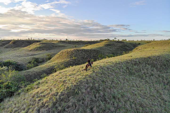
The Eastern Plains are a Colombian region known for its abundant fauna and flora, making it a must-explore destination for hiking enthusiasts. Today, I’ll introduce you to the 9 hiking trails you shouldn’t miss there.
Content
Geographic Overview of the Plains, Colombia
The Eastern Plains (Los Llanos Orientales, in Spanish), also known as the Orinoquía region, constitute one of Colombia’s six natural regions, encompassing 67 municipalities.
This region lies east of the Andes mountain range and spans various departments, primarily:
- Arauca
Capital: Arauca
Average altitude: 120 to 340 (393 to 1,115 feet) m.a.s.l.
- Casanare
Capital: Yopal
Average altitude: 180 to 1,400 (590 to 4,593 feet) m.a.s.l.
- Guainía
Capital: Inírida
Average altitude: 8 to 200 (26 to 656 feet) m.a.s.l.
- Guaviare:
Capital: San José del Guaviare
Average altitude:170 to 300 (557 to 984 feet) m.a.s.l.
- Meta
Capital: Villavicencio
Average altitude: 130 to 1,800 (426 to 5,905 feet) m.a.s.l.
- Vaupés
Capital: Mitú
Average altitude: 100 to 200 (328 to 656 feet) m.a.s.l.
- Vichada
Capital: Puerto Carreño
Average altitude: 50 to 300 (164 to 984 feet) m.a.s.l.
These departments mainly consist of a flat region with plains, savannas, and significant rivers like the Orinoco, Tomo, Vichada, Meta, crucial for navigation and fishing. Parts of Cundinamarca, Boyacá, and Norte de Santander also belong to the Eastern Plains, forming a transitional zone between the Andes and the plains.
The plains feature elevated points, including the Sierra de la Macarena and the Cerro de la Macarena, reaching approximately 2,600 meters (8,530 feet) above sea level. Another notable peak is the Sumapaz, standing at 4,306 meters (14,127 feet) above sea level.
Biodiversity in the Eastern Plains
Various bird species, such as the scarlet ibis, white heron, capybaras, and black caimans, can be observed, alongside trees like jabillo and ceiba.
These living beings inhabit ecosystems such as:
- Gallery forests
- Tropical forests
- Wetlands
- Plains
- Savannas
The combination of these diverse ecosystems and their rich biodiversity makes it an ideal place for outdoor activities such as hiking.
Hiking Trails in the Plains, Colombia
Next, I’ll provide information about the most important hiking trails in the Plains.
Here is the rubric that explains the difficulty level associated with each trail.
Difficulty levels
Moderate
The terrain is flat, asphalted or paved and clearly marked. It is not very long and does not require excessive physical effort. Suitable for the whole family.
Medium
The terrain is mostly uncovered, there is unevenness, moisture and mud. The route requires significant physical effort and is not suitable for people with reduced mobility.
Difficult
The terrain is largely uncovered, there are steep climbs, uncertain weather conditions and high physical demands. The route is usually long and not suitable for the elderly, those with heart and respiratory diseases, children under 8 years old or pregnant women.
Hiking Trail in Sotará
Sotará, situated in the southern part of Cauca, is approximately 28 km (17 miles) from Popayán, reachable in about an hour by car. At an altitude of around 2,726 meters (8,943 feet) above sea level, it is surrounded by mountains surpassing 3,000 meters (9,842 feet).
Known for its rich biodiversity, Sotará boasts diverse flora and fauna in its mountainous ecosystems, making it a perfect hiking destination.
Hiking Trail in La Macarena, Meta
La Macarena, or better known as La Macarena del Meta, is a municipality situated 233 meters (764 feet) above sea level, located 225 km (139 miles) from Villavicencio, approximately a 19-hour drive. It is renowned as a popular nature tourism destination.
Equally famous is its role as the gateway to the renowned Caño Cristales, known as “the river of five colors.”
Hiking in the Parque Nacional Natural Sierra de la Macarena
The Parque Nacional Natural Sierra de la Macarena (Sierra de la Macarena National Natural Park), located in La Macarena, is an extraordinary reserve of fauna and flora. Archaeological artifacts along the Duda and Guayabero rivers showcase petroglyphs and pictograms from indigenous cultures that once inhabited the area.
Its ecosystems include:
- Humid forests
- Flooded forests
- Shrub savannah
Home to over 456 species, including:
- Owl
- Giant woodpecker
- Caiman
- Mountain monkey
- Jaguar
- White-faced capuchin monkey
- White-throated capuchin
- Giant otter
- Agouti
To reach the park, take the route from Villavicencio to San José del Guaviare and then proceed to La Macarena. It’s an 8-hour journey: Villavicencio is 3 hours from San José del Guaviare, and San José del Guaviare is 5 hours from La Macarena.
Another option is the land route from San Vicente del Caguán, which is a 14-hour drive (602 km or 374 miles) to La Macarena, with an additional 5 hours covering about 139 km (86 miles).
Important
- Due to the topography and the area’s historical violence, reaching the park by land takes considerable time. Many opt for charter flights to La Macarena, a highly efficient option. For example, a flight from Villavicencio takes only 35 minutes.
- Pets are not allowed in the park.
- There is no accommodation in the park; lodging is available only in the municipality of La Macarena.
- Yellow fever vaccination is recommended.
Price: The park entrance has a cost.
Website: https://www.parquesnacionales.gov.co/pnn-sierra-de-la-macarena/
Caño Cristales Trail
Difficulty Level: Medium.
The terrain features many slopes and is unpaved. Given the limited infrastructure, it’s challenging for people with mobility difficulties, baby strollers, or wheelchairs to reach this site.
One-way Distance: 5 km (3 miles)
One-way Duration: 2 hours and 30 minutes
Climate: Humid tropical savannah climate
Caño Cristales, or “the river of five colors,” exhibits shades of red, pink, yellow, green, and blue due to aquatic plants called Macarenia clavigera. These plants acquire different colors based on light and temperature conditions. The stunning colors and clear water make Caño Cristales a unique place worldwide.
Note that there are several trails:
- Eagle’s Leap Trail
- Carpet Trail
- Pailones Trail
- Silent Lagoon Trail
For Caño Cristales, fly to La Macarena, then walk to the Guayabero River bank and take a boat to La Cachibera village. Many boatmen also serve as guides. From there, use a truck or 4×4 to reach the Cajuche spring, followed by a 40-minute walk through dense vegetation to Caño Cristales.
At the Tourist Pool, the first stop, swimming is allowed, but be cautious to avoid disturbing the plants. Continuing, you’ll find Los Ochos, small stone holes forming cascades, and El Tapete, the most famous spot, covered by the red aquatic plant Macarenia.
Return using the same route.
Important
- Caño Cristales is a lengthy river, spanning 100 km (62 miles) with various tourist attractions. Moreover, it’s a mountain range. Therefore, it’s recommended to take the complete tour lasting 2 to 3 days. You’ll see waterfalls, more mountain range ecosystems, small pools, and endemic animals.
- Yellow fever vaccination is recommended, although it’s not mandatory for park entry.
- Wear water shoes and a swimsuit.
- Camping is not allowed in Caño Cristales.
- You must go with a guide.
- If you plan to immerse yourself or touch the river water, avoid using sunscreen or repellent. Opt for lightweight, long-sleeved clothing for protection.
Price: The park entrance has a cost.
Hiking Trail in Inírida, Guainía
Inírida, one of Colombia’s most remote and pristine regions, is accessible only by air. At 95 meters (311 feet) above sea level, it showcases unique biodiversity and a rich indigenous culture.
The natural environment in Inírida is captivating, with tropical forests, rivers, and lagoons. The Inírida River is central to the community’s life, providing opportunities for fishing, canoeing, bird watching, and wildlife exploration.
Hiking in the Cerro de Mavecure
Difficulty Level: Medium.
The trail is mostly flat, but there’s a lot of mud and small streams.
One-way Distance: 2.5 km (1 mile)
One-way Duration: 2 hours and 30 minutes
Altitude: Starting at 175 meters (574 feet) and ending at 227 meters (744 feet) above sea level
Climate: Humid tropical savannah climate
The Cerro de Mavecure (Mavecure Hills) are rock formations located south of Inírida, a 1-hour and 30-minute boat ride along the Inírida River. They are famous for their impressive rise from the Amazonian plains, comprising three main mountains:
- Mavecure: 170 meters (557 feet)
- Mono (Monkey): 480 meters (1,574 feet)
- Pajarito (Little Bird): 712 meters (2,335 feet)
- The route around Cerro Pajarito is one of the more extensive options but is the most frequented because it leads to exploring a natural trail. As climbing Cerro Diablo, next to Cerro Pajarito, is allowed, you’ll have an excellent view of the other two hills, the Inírida River, and the surrounding ecosystem.
Here are the stages of your journey:
- Register to enter the El Remanso indigenous community.
- After registration, take a short walk to explore the community.
- From the community, start a walk around Cerro Pajarito. It has two sections: the first is through a route filled with vegetation, and the second, closer to the hill, is rockier and has fewer plants.
- Once you’re at the back of Cerro Pajarito, begin a 300-meter (984-foot) ascent to Cerro Diablo. When you reach the top, you can rest and enjoy the view.
- You can return via the same route.
This site not only offers tourist attractions but also cultural experiences. Indigenous culture will be present at every step.
Important
- This area covers a vast expanse, so one day is not sufficient to explore all its tourist offerings. I suggest staying in El Remanso and participating in their other ecotourism offerings.
- When climbing the hills, it’s practical to bring a hiking pole. I recommend a collapsible one for ease of transport.
Website: http://www.colparques.net/MAVECURI
Hiking in the Serranía de La Lindosa Natural Reserve
The Serranía de La Lindosa Natural Reserve is a protected natural area located 17 km (10 miles) from San José del Guaviare, with a 35-minute car journey.
It encompasses a rocky mountain range where you can find various caves and water channels. Additionally, you will encounter intriguing cave paintings with over 12,000 years of history, as these caves served as rocky shelters for indigenous communities in the area, such as:
- Guahibo
- Carijona
- Tukano
Therefore, this site has been declared a Protected Archaeological Area of Colombia.
Trail to Cerro Pinturas
Difficulty Level: Medium.
One-way Distance: 4 km (2 miles).
One-way Duration: 2 hours and 30 minutes.
Altitude: Starting at 175 meters (574 feet) and finishing at 227 meters (744 feet) above sea level.
Climate: Tropical savannah climate.
Cerro Pinturas, the main archaeological site, accessed through Cerro Azul, 1.5 hours within the reserve. The trail starts flat, transitions through dense jungle, showcasing trees, ferns, birds, and titi monkeys.
During the journey, explore 4 murals with red or ocher pictograms, depicting animals, plants, human figures, and hunting rituals. Pass through 21 caves to reach the Cerro Pinturas viewpoint, offering a spectacular panoramic view of San José del Guaviare and nearby territories—ideal for incredible photos.
Return follows the same trail.
Important
- Do not touch the paintings or bring pets.
- Wear long-sleeved clothing to protect yourself from mosquitoes and the sun.
- Hire a local guide for the journey.
- The road to the reserve is unpaved; it is recommended to use a high or 4×4 vehicle.
Price: Entrance to the park has a fee.
Hiking Route in Puerto Carreño, Vichada
Puerto Carreño is a municipality known for its rich nature and biodiversity. Situated at 51 meters (167 feet) above sea level, this location offers landscapes of savannahs, jungles, rivers, and waterfalls, ideal for hiking and observing flora and fauna. Additionally, the llanera culture is at the heart of Puerto Carreño, where visitors can enjoy music, dances, and traditional gastronomy at local festivals and events.
The combination of lush nature and llanera culture makes Puerto Carreño a unique destination in Colombia for nature and adventure enthusiasts.
Hiking in Parque Nacional Natural El Tuparro
The Parque Nacional Natural El Tuparro (Tuparro National Natural Park) is one of Colombia’s largest natural reserves, located in Puerto Carreño. Its objective is to conserve the biodiversity of the ecosystems it houses:
- Flooded and dry savannas
- Gallery forests
- Rocky outcrops
- Mainland forests
In this area, you can find over 320 species, including tapirs, pumas, mountain lions, and charapa turtles. Additionally, it’s an ideal place for ecotourism, offering birdwatching and hiking opportunities. Moreover, the park is home to indigenous communities.
There are many trails to explore in the park:
- Attalea Trail
- Atarrayadero Trail
- Caño Peinilas
- Cerro Thomas
But let’s focus on the most popular ones.
Firstly, you should know that the only access route by land is from Villavicencio, through the Amanecer Llanero route. You’ll pass through the municipalities of Puerto López and Puerto Gaitán until you reach the trails towards Puerto Carreño, which is very close to the park’s main entrance, around 660 km (410 miles) away.
Another way to get there is by flying to Puerto Carreño, the most recommended, quick, and safe option.
Important
- Camping and fishing are not allowed in the park.
- Pets are not allowed in the park.
Price: The entrance to the park has a fee.
Website: https://www.parquesnacionales.gov.co/nuestros-parques/pnn-el-tuparro/
Anaconda Trail
Difficulty Level: Medium.
Flat topography, with a marked trail, but demanding due to the heat.
One-way Distance: 2.5 km (1.5 miles).
One-way Duration: 1 hour and 30 minutes.
Climate: Tropical savannah climate.
This trail starts at the El Tomo administrative center, one of the park’s entrances, and takes you through a route full of vegetation to the blue wells water sources. During the journey, birdwatching and photography are common activities.
You can return using the same trail.
Raudales de Maipures (Attalea) Trail
Difficulty Level: Medium.
One-way Distance: 3 km (1.8 miles).
One-way Duration: 2 hours and 30 minutes.
Climate: Tropical humid savannah climate.
The Maipures Rapids are geological formations located on the Orinoco River, creating numerous holes, currents, and waterfalls due to the current, truly magnificent. They are one of the most imposing attractions offered by El Tuparro National Natural Park.
In fact, in the year 1800, the renowned German naturalist Alexander von Humboldt called this place “the eighth wonder of the world.”
To reach this tourist attraction, you must take a boat on the banks of the Orinoco River to the Maipures sector, taking about 40 minutes.
Here is the route you will take:
- Observe the El Guahíbo Rapids, which are near the mouth of the Tuparro River.
- Navigate again on the Orinoco River to the Maipure Visitor Center.
- Walk about 900 meters (2,952 feet) along the Attalea Trail, a route that passes through the rocky outcrop.
- Traversez le sentier à travers la jungle jusqu’au point de vue qui offre une vue totale sur les rapides de Maipure et la savane du sud du parc.
- Maipure et la savane du sud du parc.
- After enjoying that incredible view, descend to the visitor center. There, you will take a boat for 15 minutes to the rapids of Tuparro, where swimming is allowed. The water is warm.
- At this point, you could turn back, but if you continue by boat, you can see the Balancín, a huge rock perfectly balanced on another smaller one—seemingly impossible! In this area, you will see many birds and ochre-colored rocks.
- You can return on the same trail or take additional boat trips.
Important
- The best time to visit this place is during the summer months, between December and March.
- You must go with a local guide.
- Local communities or nearby tourism companies offer accommodation, transportation, and guidance.
- Wear long-sleeved clothing; there are many mosquitoes.
Price: The entrance to the site has a fee.
Hiking Route in San José del Guaviare, Guaviare
San José del Guaviare is a municipality at an altitude of 175 meters (574 feet) above sea level, known for its impressive natural environment and cultural richness. The region boasts diverse geography, including jungles, rivers, and unique rock formations.
The Guaviare area is a paradise for nature lovers, providing opportunities for hiking, wildlife observation, and fishing in local rivers.
Hiking Route in Tauramena, Casanare
Tauramena is a municipality in the department of Casanare, at an altitude of 460 meters (1,509 feet) above sea level. It is characterized by its natural beauty and importance in the oil industry. The region offers a variety of natural environments, including plains, rivers, and jungles.
Similarly, it is home to abundant wildlife, and activities such as hiking, fishing, and bird watching are popular among visitors. It is located 66 km (41 miles) from Yopal, about 1 hour by car.
Hiking in Laguna El Juncal
Difficulty Level: Moderate.
Flat and marked trail. No major elevations or complex crossings.
One-way Distance: 1 km (0.6 miles).
One-way Duration: 1 hour.
Climate: Tropical savannah climate.
Laguna El Juncal, often referred to as the “enchanted lagoon,” is located in the Visinaca district, just 35 minutes (20 km or 12 miles) from Tauramena’s urban center. Many believe that the Mohán, a folkloric guardian figure with both good and bad qualities, used to inhabit the area.
Covering 18 thousand square meters, the lagoon allows navigation or hiking around it. The trail, starting at a turtle sculpture for photo opportunities, is teeming with fauna and flora, including large trees, turtles, fish, and birds.
Fishing is permitted, and the return journey follows the same path.
Important
- The route is unpaved, and there are many stones; it is suggested to go in a high or 4×4 vehicle.
- Do not enter the lagoon without a guide or authorization from the responsible parties.
- If you navigate the lagoon, it is practical to bring a change of clothes.
Price: The entrance to the site has a fee.
Hiking Route in Mitú, Vaupés
Mitú is a place of great natural beauty and rich cultural diversity. It is located at an altitude of 183 meters (600 feet) above sea level. It is famous for its stunning natural surroundings, including dense jungles, rivers, and a wide variety of unique ecosystems.
Indigenous culture is a fundamental part of life in Mitú. Therefore, visitors have the opportunity to learn about the rich cultural heritage of these communities and immerse themselves in nature.
Hiking on Cerro Guacamayas
Difficulty Level: Medium.
The trail is mostly flat, but there is a lot of mud and small streams.
One-way Distance: 2 km (1 mile).
One-way Duration: 2 hours and 30 minutes.
Altitude: Starting at 175 meters (574 feet) and finishing at 227 meters (744 feet) above sea level.
Climate: Tropical humid savannah climate.
Cerro Guacamayas, a notable tepuy in Mitú, is situated in the Mitú Cachivera indigenous reserve, just 45 minutes from the urban center. These rocky hills hold natural and spiritual significance for locals.
To reach the summit, start at the wooden bridge, following a path through indigenous crops. Along the way, you’ll encounter Caño Sangre, recognizable for its reddish hue—avoid swimming until your descent.
The journey is initially flat, but as you approach the mountain, the ascent becomes challenging, requiring rope assistance due to the steep terrain. Sparse vegetation indicates the summit’s proximity, offering an impressive panoramic view of vast jungle landscapes.
The return follows the same route, and for a refreshing break, consider swimming in Caño Sangre.
Important
- Wear swamp or waterproof boots.
- Wear long-sleeved clothing to protect yourself from mosquitoes and the sun.
- Hire a local guide for this journey.
Hiking Route in Tame, Arauca
Tame is located 107 km (66 miles) from Arauca, the capital of the department. The car journey takes almost 3 hours. It has an altitude of 343 meters (1,125 feet) above sea level and is frequented by many visitors due to its natural beauty and its importance in the Colombian oil industry.
It is a place that offers a unique combination of natural environments and llanera cultural activities.
Hiking in Cañón del Cravo
Difficulty level: Medium.
Although the trail is not very demanding, there are many slopes and stones.
One-way distance: Not specified.
One-way duration: Not specified.
Climate: Tropical humid savanna.
Cañón del Cravo, situated in the La Escalera reserve, is just 20 km (12 miles) from Tame’s urban area, reachable in about 30 minutes by car. It is also nestled in the foothills of the Cocuy snow-capped mountain.
The primary route in the La Escalera reserve involves reaching Cañón del Cravo at an altitude of 116 meters (380 feet) above sea level. From there, you’ll proceed to the Cravo River and finally connect with the Cocuy snow-capped mountain, where camping is permitted. This trail is renowned for bird watching, showcasing a variety of endemic fauna and flora.
With over 180 bird species, you may also encounter the Churuco monkey, a small primate endemic to the region.
The return journey follows the same route.
Important
- You must be accompanied by a local guide.
- Pets are not allowed.
- I recommend wearing swamp or waterproof boots.
Price: There is an entrance fee to the reserve.
Hiking Route in Uribe, Meta
Uribe is a municipality located at 835 meters (2,739 feet) above sea level in the Meta department. It is 187 km (116 miles) from Villavicencio, approximately 4 hours and 30 minutes by car. It is known for its natural beauty and its proximity to areas of great ecological interest.
In addition to its natural richness, Uribe also has an important cultural heritage and is home to various indigenous communities.
Hiking in the Parque Nacional Natural Cordillera de Los Picachos
The Parque Nacional Natural Cordillera de los Picachos (Cordillera de los Picachos National Natural Park) is located on the slope of the Eastern Cordillera, specifically between the municipalities of San Vicente del Caguán and Uribe. To get there, you must take the trail that passes through the La Esperanza and San Jorge neighborhoods to Hacienda Andalucía, which is about 6 hours by car.
Because it is located in the Andean-Amazonian territorial transition, it has various ecosystems:
- Páramo: Not available for hiking.
- Andean forests
- Humid jungles
- Gallery forests
In these areas, you can enjoy hiking, lodging, and observing the park’s different 881 species of fauna and flora, including:
- Crested eagle
- Amazonian tapir
- Black guan
- Jaguar
- Churuco monkey
- Nocturnal monkey
- Spectacled bear
- Harlequin frog
- Warty snake
- Tigrillo
- Woodpecker
- White-tailed deer
Likewise, more than 310 species of flowering plants and ferns have been identified, such as cartridges, laurels, and palms.
Andean forest of the Parque Nacional Natural Cordillera de Los Picachos: 3 hiking routes
Climate: Tropical savanna.
The Andean forest of this park comprises the middle zones of the Eastern Cordillera, located between 1,800 and 2,800 meters (5,905 to 9,186 feet) above sea level. This area contains a large amount of food for local wildlife. Likewise, much of the research and monitoring of fauna and flora have been carried out within this ecosystem.
In this ecosystem, there are 3 enabled hiking routes:
- Andalucía Trail
- Coreguaje Trail
- El Venado Trail, where you can see the Salto del Venado, a popular destination with a waterfall over 50 meters (164 feet) high.
However, there is no additional information describing these sections. What is known is that they are routes full of vegetation, and you can visit numerous waterfalls.
Important
- To enter the trails of the protected area, you must hire the services of a guide.
- You can request the list of authorized guides at picachos@parquesnacionales.gov.co.
- Pets are not allowed in the park.
- The rainiest months are April, December, and from May to July. I suggest hiking in the other months.
- It is recommended to be vaccinated in advance for yellow fever and tetanus.
- The local farming communities offer accommodation and food services.
- In the surrounding areas, there are military posts, so it is practical to carry your identification documents and explain the purpose of your visit.
Website: https://www.parquesnacionales.gov.co/nuestros-parques/pnn-cordillera-de-los-picachos
Other Important Hiking Routes in the Eastern Plains, Colombia
In the Eastern Plains, there are various parks and nature reserves. Among the most prominent are the Sumapaz National Natural Park and the Tinigua National Natural Park. These are two vast biodiversity reserves. Therefore, they have ecological importance and, due to the abundance of fauna and flora, often offer ecotourism services related to hiking.
Unfortunately, they are currently closed due to the fragility of the ecosystem, lack of infrastructure, and their conservation status. There is no information on when they will be reopened. Therefore, it is good to check their condition on the official National Parks website before planning your trip.
Climate in Easter Plains, Colombia
The climate in this Colombian region is very varied because it is directly influenced by the number of departments, geographical position, winds, and relief. These form different climatic conditions depending on the altitude above sea level.
The Orinoquia region is characterized by an average temperature of 27°C (80°F). However, to give you an idea, three prevail in this region:
- Tropical Savanna Climate (22°C to 32°C/71°F to 89°F): This is the most common climate in the Eastern Plains. It is characterized by warm temperatures throughout the year and a rainy season. Temperatures can be high, with minimums rarely dropping below 20°C and maximums that can exceed 30°C. Villavicencio, which is at an altitude of 467 meters (1,532 feet) above sea level, is an example.
- Short Dry Season Savanna Climate (18°C to 30°C/64°F to 85°F): Some areas of the Eastern Plains experience a shorter and less pronounced dry season, classified as a short dry season savanna climate. Despite the shorter duration of the dry season, temperatures and rainfall remain typically tropical. It is common in Puerto Carreño, at an altitude of 51 meters (167 feet) above sea level.
- Humid Tropical Savanna Climate (20°C to 32°C/69°F to 89°F): In some areas, more humid climates with more abundant rainfall throughout the year can be found. This leads to denser vegetation and greater diversity of flora and fauna. It is especially common in places like the Sierra de la Macarena, at an altitude of 1,600 meters (5,249 feet) above sea level.
Precipitation in the Easter Plains
This region has high levels of precipitation throughout the year, ranging from 2500 mm to 6000 mm. The months with the most rain are divided into two periods: one from April to May and another from September to October. For hiking, I suggest going from November to April and from May to September.
Remember that the departments of Vichada, Guaviare, and Guainía are known for receiving a greater amount of rain compared to other departments in the region.
Recommendations for Hiking in the Easter Plains
To have a better experience, I advise you to follow the rules of each of the places.
These are usually stipulated by government entities with the aim of preserving a certain ecosystem. The following are the most common rules:
- Do not leave trash.
- Do not take animals out of their habitats.
- Do not cut or tear plants.
- No smoking.
- You cannot hunt.
- If not clearly allowed, do not bring pets to protected areas.
- Do not throw anything into water sources.
- Avoid making fires in unauthorized areas.
- Do not take shortcuts or walk in unauthorized areas.
- Do not consume alcoholic beverages or psychoactive substances.
- Do not go on excursions in dangerous weather conditions.
- Do not camp where it is not allowed.
- Do not listen to music with speakers.
On the other hand, to avoid setbacks, these tips will help you:
- Plan your route in advance.
- Be careful with online reservations; sometimes, they are scams.
- Look for information on official and government websites, where you can find it in English.
- Hire a reliable guide with a national guide card.
- If you have health problems, it is essential to inform your companions.
- Foreigners should do these routes in groups.
- Start your journey early in the morning to avoid the sun and high temperatures.
Something that is essential to keep in mind is that this area of Colombia has very little or deficient road structure. Additionally, being areas with immense water sources, in many cases, navigation service applications fail to recognize the routes. As a result, it is easy to get lost. Therefore, when traveling there, the fastest and easiest way is by plane.
However, as I mentioned earlier, these are usually remote areas. Therefore, very few airlines cover these routes. The most convenient thing is to look for routes that do offer these services or travel on charter flights.
What you should bring for Hiking in the Estern Plains
Hiking requires some preparations and gear. Here are some suggestions for what you could bring:
- A backpack
- A hiking stick
- Comfortable and appropriate clothing and footwear according to the weather
- Raincoat
- Identification documents
- Water and snacks
- A whistle
- A first aid kit
- Sunscreen and a hat
- Personal use medications
- Change of clothes and shoes
- Local cash.
Contact us, and we will be more than happy to help you with your new adventure. Until next time, traveler!
More Nature Tourism Experiences in Colombia
Here is a list of incredible destinations for hiking and other nature activities in Colombia:
- The Best Hiking Routes in Colombia.
- The Most Representative Flowers in Colombia.
- Cacao Guide in Colombia.
Other recommended hiking trails
- Discover the 7 Best Hiking Routes in Antioquia, Colombia
- The 7 Most Incredible Hiking Routes in Boyacá, Colombia
- The 9 Best Hiking Routes in Cundinamarca, Colombia
- Hiking in Santander, Colombia – 5 Incredible Routes
- How to Hike the Lengerke Trail in Colombia: A Complete Guide
- Hiking in Colombia’s Coffee Region: Top 5 Must-Visit Routes
- Must-Try Hiking Trails in Magdalena, Colombia
- Discover 4 Must-Visit Hiking Trails in Amazonas, Colombia
- The 6 Best Hiking Trails in Tolima, Colombia
- Climbing Tolima Volcano: A Challenging Andes Adventure
- 5 Must-Experience Hiking Routes in Huila, Colombia
- 5 Must-Experience Hiking Trails in Valle del Cauca, Colombia
- 6 Must-Experience Hiking Trails in Cauca, Colombia
- Explore 9 Scenic Trails in Eastern Plains, Colombia
- Hiking in Colombia: Checklist of 23 Essential Items to Bring
