
Updated on 03/13/2024
Dear reader,
I would also like to recommend our Colombia travel guide, which provides a perfect overview of the tourist attractions in Colombia. Enjoy reading it!
The Amazonas department is an unparalleled natural treasure that you can explore through its lush trails. So, I will present the 4 hiking routes you shouldn’t miss.
Content
Geographical Overview in Amazonas, Colombia
The Amazonas department is situated in the southeastern part of Colombia, with an average altitude ranging from 262 to 328 feet above sea level. It comprises two municipalities, Leticia and Puerto Nariño, along with 9 townships, 5 hamlets, and 29 populated centers. The department shares its borders with Peru and Brazil.
This region boasts an extensive hydrographic system, featuring three primary rivers: the Putumayo River, the Caquetá River, and the Amazon River, as well as various other streams, channels, secondary rivers, and river arteries.
The Amazonas department is predominantly flat, covered by an expansive and dense tropical rainforest. While it contains some hills and mountain ranges, such as the Pedrera Hills and the Hombres Chiquitos Hills, none of these elevations exceed 984 feet above sea level.
This area is renowned for its rich vegetation and biodiversity, often referred to as the ‘lungs of the world.’ Additionally, it is home to ancestral cultures, and their influence, legacy, and customs are prominent throughout the territory.
Hiking Routes in Amazonas, Colombia
Now, I will provide you with information on the top 4 hiking routes in Amazonas, Colombia. There will be highly popular routes and others that are less known.
This is the key that will explain the difficulty level assigned to each route.
Difficulty levels
Moderate
The terrain is flat, asphalted or paved and clearly marked. It is not very long and does not require excessive physical effort. Suitable for the whole family.
Medium
The terrain is mostly uncovered, there is unevenness, moisture and mud. The route requires significant physical effort and is not suitable for people with reduced mobility.
Difficult
The terrain is largely uncovered, there are steep climbs, uncertain weather conditions and high physical demands. The route is usually long and not suitable for the elderly, those with heart and respiratory diseases, children under 8 years old or pregnant women.
Hiking Trails in Leticia, Amazonas
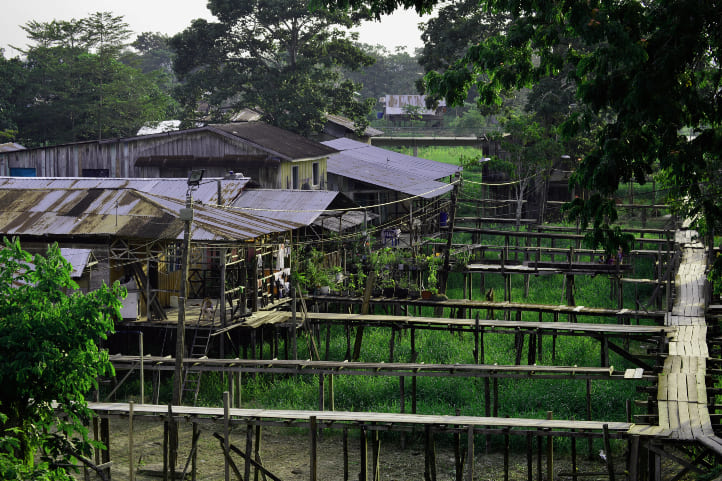
Leticia, Amazonas’ capital, offers nature and adventure enthusiasts an extraordinary experience. Surrounded by rich biodiversity, this city is home to unique flora and fauna, including toucans, harpy eagles, capuchin monkeys, pumas, anacondas, and pink dolphins.
Situated at approximately 314 feet above sea level, Leticia has a hot and humid tropical climate. It’s a hub for tourism and hiking, providing a chance to witness diverse wildlife in its natural habitat and interact with the region’s 13 indigenous ethnic groups, such as the Huitoto, Bora, Macuna, Yagua, and Ocaina.
What makes Leticia special is its ability to balance the rural and urban lifestyles, offering shops, universities, a cathedral, restaurants, a hospital, and hotels alongside its natural charm.
Maikuchiga
The Maikuchiga primate reserve, located 43 miles from Leticia in Mocagua, rehabilitates various primate species. It offers a unique opportunity for visitors to observe these animals in their natural Amazon rainforest habitat.
However, remember that this is a sanctuary, not a place for displaying animals, so avoid feeding or disturbing them. The reserve is home to titi monkeys, capuchin monkeys, squirrel monkeys, flying monkeys, and more. You can also spot a variety of birds.
The Mocagua community used to consume these primates, but now they focus on preserving and protecting these species through ecotourism.
Hiking on the Ome Mai Trail
Difficulty level: Moderate.
The trail is flat and partly paved. There are several stops.
Distance to be covered: 0.6 miles one way on the island.
Duration: 40 minutes.
Climate: hot and humid.
To reach Maikuchiga, take a 45-minute boat ride from Leticia. The boat trip includes approximately 15 minutes on the Amacayacu River before reaching the Amazon River and eventually arriving at the Mocagua community on the island.
From there, follow the Ome Mai route, which leads to the primate rehabilitation center. The walk takes around 40 minutes and involves walking through the village, crossing a stream, and navigating a muddy forest path.
Expect muddy conditions during the journey.
At the center, you can observe the animals being trained to live independently in the jungle. They are fed in a small building, and you can observe them there.
Throughout the route, you’ll receive information about the conservation and protection of the Amazonian ecosystem.
You can return along the same trail, and the village offers accommodation and dining options.
Price: The entrance to the island and the section where the monkeys are located have a cost.
Important
This reserve aims to protect the species. Therefore, I recommend being very respectful and careful with the environment.
If you are going in a group, it is best to have fewer than 5 people.
Bring waterproof boots and insect repellent.
Website: https://www.maikuchigafundacion.org/ome-mai-y-visita-al-centro
Hiking in Tanimboca Natural Reserve
Difficulty level: medium.
The walk is not rushed, with several stops. However, it can get quite hot. It is not recommended for women with high-risk pregnancies to travel by boat in this area.
Distance to be covered: 1 mile through the entire reserve in secondary forest areas.
Duration: 3 hours.
Climate: hot and humid.
The Tanimboca Natural Reserve, located around 6.21 miles from Leticia, offers a variety of ecotourism activities, including canopy tours, rock climbing, dolphin, bird, and monkey watching, visits to indigenous houses, river and tributary trips, and hikes in the virgin rainforest.
For a rewarding experience, begin with a guided tour of the reserve, taking you to the indigenous maloca and the Tacana River. Local guides will share knowledge about endemic species, folk stories, and provide opportunities for bird and monkey sightings. You can capture great photos and visit indigenous settlements during the trip.
The trail within the reserve can be subject to change due to weather conditions or other factors, so flexibility is key. The reserve also offers guided multi-day hikes through the virgin rainforest, ranging from 1 to 8 days, with a local guide. These longer treks are a physically challenging yet unforgettable adventure. Adequate preparation is essential if you opt for one of these extended hikes.
Important
Don’t forget to wear waterproof boots and stay hydrated.
Opening hours: Tuesday to Saturday from 9:00 am to 5:00 pm.
Price: The entrance fee and tourist packages have a cost.
Website: https://www.tanimboca.org/
Hiking on the Dea Chiga Trail
Difficulty level: Moderate.
The climate can be exhausting, and there are no shops along the way. However, it is not an extensive route.
Distance to be covered: 1.4 miles one way on the Dea Chiga Trail.
Duration: 2 hours.
Climate: hot and humid.
This trail is located in the San Sebastián de Los Lagos indigenous reserve.
The Dea Chiga Trail starts with an ascent of some stairs, and during the journey, you will encounter the following stations or points in this order until you reach the end:
- Dea Chiga Trail Start
- Micos Station
- Birth of Waters Station, use waterproof boots here
- Clear Waters Point
- Medicinal Plants Area
- Crystal Clear Waters Point
- Yahuarcaca Rest Station
- Bird Watching Zone
- Uhito Station
- Wind Sound Point
- Yauarcaca Stream
- Cururu Station
- End of the trail
At each station, you will walk from 229 to 459 feet, and you can return along the same route. It is a very harmonious and tranquil trail, filled with trees such as cedar, aguaje, and mahogany, among other species. Additionally, throughout the trail, you will hear birds celebrating the warm climate.
Important
Carry waterproof boots and a guide to lead this excursion.
Go in small groups; fewer than 5 people are recommended.
Hiking Trails in Puerto Nariño, Amazonas
Puerto Nariño is a riverside town on the Amazon River, about 54 miles from Leticia. To reach it, you’ll need to take a boat ride along the river, which takes approximately 1.5 hours and requires paying a tourist tax upon arrival.
This eco-friendly destination is perfect for nature lovers and offers jungle exploration, birdwatching, swimming with pink dolphins, and a chance to experience local indigenous cultures.
Hiking in Amacayacu National Natural Park
The Amacayacu National Park, located between Puerto Nariño and Leticia, covers 293,500 hectares and represents 40% of the Amazon Trapezium. It is a warm tropical rainforest with floodable forests and hosts the highest primate diversity globally, along with over 5,000 plant species, 500 bird species, and 150 mammal species.
Additionally, it is home to various reptiles and unique wildlife, including lion tamarins, manatees, pink dolphins, caimans, silvery blue butterflies, and the world’s largest lotus flower.
This area shares territories with the Tikuna ethnic group, and you can enjoy ecotourism activities such as species observation, canoeing, night hiking, and visiting the indigenous community of San Martín de Amacayacu, accessible by boat or hiking.
Hiking in San Martín de Amacayacu
Difficulty level: Medium.
There are paved sections of the trail, but most of it is on land. Although the vegetation provides shade, it can get quite hot in this area, and mosquitoes are abundant.
Not recommended for women with high-risk pregnancies.
Distance to be covered: 4.970 miles one way to the San Martín de Amacayacu community.
Duration: 4 hours.
Climate: hot and humid.
San Martín de Amacayacu is a designated area within Amacayacu National Natural Park for ecotourism. It offers accommodation, food, wildlife and flora observation, and of course, jungle tours. While there, you can taste typical dishes, enjoy artistic performances, and learn about indigenous arts such as basket weaving and pottery.
There are several ways to get there, with the main one being by boat, which you can take from Leticia and request to be dropped off at the mouth of Amacayacu. You can also walk from the park’s entrance in Puerto Nariño, enjoying the beautiful trail.
The path is clearly marked as it has been used for 40 years, first by locals going to school in Puerto Nariño and now also by tourists. Nonetheless, I recommend going with a guide.
During the trail, you will come across several key points:
- After walking 328 feet, you will start the route at the Puerto Nariño water treatment plant.
- At about 675 feet, you will find a maloca with recreational activities.
- After 3 intersections and 1,608 feet, you will reach the bridge, which is in poor condition, so it’s better to pass on land.
- From there, you will walk a long stretch and encounter another dilapidated bridge, which is often flooded.
- Here, you begin the final stretch on the Amacayacu River, which is about 223 feet by boat, then a short walk, and you will have arrived.
This exceptional route is covered by a dense canopy of trees, and the air is the purest you will ever breathe.
Important
If it’s your first time there, it’s crucial to go with a guide who is also an interpreter, as some guides may not speak the local indigenous languages. I also suggest walking at your own pace, staying hydrated, and wearing waterproof boots since there is a lot of mud on the trail.
Wear long-sleeved clothing, a hat or cap, and insect repellent.
The maximum capacity for the trail is 5 to 6 people per hike.
Price: There is an entrance fee for the park and for Puerto Nariño.
Website: https://www.parquesnacionales.gov.co/nuestros-parques/pnn-amacayacu/#ecoturismo
Climate in Amazonas, Colombia
The climate in this Colombian department is not very diverse due to its few geographical features. However, it is characterized by constant rainfall and high humidity, which creates a specific climatic condition based on altitude relative to sea level.
In the department, a warm and humid climate 74.3°F to 81.68°F prevails, characterized by high temperatures and frequent rainfall. The average temperature in the department is 77°F. However, temperatures rise during the months of January to March and July to September.
Humidity: The relative humidity is high, making the atmosphere and air feel heavy. The average annual humidity exceeds 85%.
What Is the Best Time for Hiking in Amazonas, Colombia?
Knowing the seasons, i.e., weather patterns, can help you plan your trip to the Amazon better. Why? Because depending on the seasons, you can enjoy various tourist activities.
For example, when the waters recede, you can observe the arrival of turtles. But when the waters are high, it’s possible to navigate through flooded jungle areas.
- From December to March and from September to November: the waters are rising because of significant rainfall and high temperatures, making many areas inaccessible.
- From April to May: the river is at its highest level, and it is the “rainy season.” Usually, the month with the heaviest rainfall is March, although it can sometimes extend from April to May. Rainfall can exceed 4,000 millimeters (0.2441 inches) per year.
- From June to August: the season of falling waters begins. This is the best time for hiking, including sometimes in October. Although it’s quite hot during these months, the water level drops, allowing access to various routes as the mud dries up.
Recommendations for Hiking in Amazonas
To have a better experience, I recommend following the rules of each place. These are usually stipulated by government entities with the goal of preserving a particular ecosystem. The following are the most common:
- Don’t litter.
- Don’t take animals out of their habitats.
- Don’t cut or uproot plants.
- Don’t smoke.
- Don’t bring pets.
- Don’t throw anything into water sources.
- Don’t take shortcuts or walk in restricted areas.
- Don’t consume alcoholic beverages or psychoactive substances.
- Don’t go on excursions in dangerous weather conditions.
- Don’t play music with speakers.
Additionally, to avoid any mishaps, these tips will serve you well:
- Plan your route in advance.
- Be cautious with online bookings, as there can be scams.
- Look for information on official government websites; often, this information can be found in English.
- Hire a reliable guide with a national tourism guide card.
- If you have health issues, it’s essential to inform your companions.
- Foreigners should undertake these journeys in groups.
- Start your hike early in the morning to avoid the sun and extreme temperatures.
Specific Tips for Visiting the Amazonas
The Amazonas is not an ordinary place, and you will likely encounter heavy rains or dangerous animals every day. Therefore, you should keep these more specific suggestions in mind:
- Protect your electronic devices by placing them in waterproof bags or protectors.
- Hire a guide who is also an interpreter since more than 300 languages are spoken in this area.
- Change your socks frequently.
- Use insect repellent in cream form, not in aerosol, and avoid using insecticides in the environment.
- Get vaccinated against yellow fever 10 days before your trip.
- Get Claro and Tigo SIM cards or activate roaming services; they are the only way to get a signal in this area.
- Don’t consume species that are endangered or restricted.
- Carry a container with potable water with you at all times and do not drink tap water.
- Do not enter the jungle or river areas with potential hazards without a local guide.
- If you think you’ve been bitten by a venomous animal, ask the locals or your guide for immediate first aid.
What to Bring for Hiking in Amazonas
Hiking requires some preparations and equipment. Here are some suggestions for what you should bring:
- A backpack
- A hiking pole
- Waterproof boots
- Comfortable and weather-appropriate clothing and footwear that covers your skin
- Identification documents
- Swimsuit
- Non-perishable food and water
- A first aid kit
- Sunscreen and a cap
- Personal medications
- Change of clothes and shoes
- Local cash
Feel free to contact us, and we will be more than happy to assist you in your new adventure. Until next time, traveler!
More nature tourism experiences in Colombia
Here you will find a list of incredible destinations for hiking and other nature activities in Colombia:
- Best 9 Hiking Regions and 27 Routes in Colombia For Travelers
- Colombian Flowers: The Top 11 Most Representative Species
- Cocoa Guide Colombia – Features & Producers
More recommended hiking trails
- Discover the 7 Best Hiking Routes in Antioquia, Colombia
- The 7 Most Incredible Hiking Routes in Boyacá, Colombia
- The 9 Best Hiking Routes in Cundinamarca, Colombia
- Hiking in Santander, Colombia – 5 Incredible Routes
- How to Hike the Lengerke Trail in Colombia: A Complete Guide
- Hiking in Colombia’s Coffee Region: Top 5 Must-Visit Routes
- Must-Try Hiking Trails in Magdalena, Colombia
- Discover 4 Must-Visit Hiking Trails in Amazonas, Colombia
- The 6 Best Hiking Trails in Tolima, Colombia
- Climbing Tolima Volcano: A Challenging Andes Adventure
- 5 Must-Experience Hiking Routes in Huila, Colombia
- 5 Must-Experience Hiking Trails in Valle del Cauca, Colombia
- 6 Must-Experience Hiking Trails in Cauca, Colombia
- Explore 9 Scenic Trails in Eastern Plains, Colombia
- Hiking in Colombia: Checklist of 23 Essential Items to Bring
- The 9 Wild and Adventurous Hiking Routes in the Colombian Andes
- 9 Hiking Routes in Colombia Ideal for Families
