
Updated on 04/17/2024
Dear reader,
I would also like to recommend our Colombia travel guide, which provides a perfect overview of the tourist attractions in Colombia. Enjoy reading it!
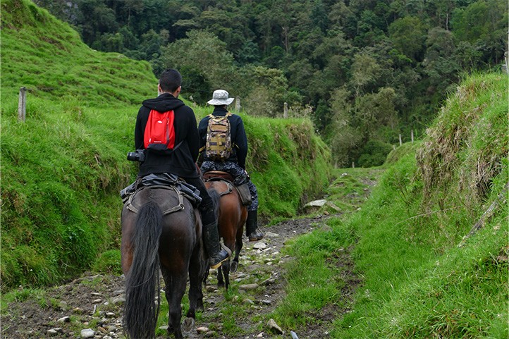
The Coffee Axis is a Colombian region full of natural beauty and, of course, coffee culture! It offers various tourist activities such as coffee plantation tours and hiking. So, I’ll introduce you to the 5 hiking routes you can’t miss.
Content
What is the Coffee Axis?
The Coffee Axis encompasses the Colombian departments of Caldas, Quindío, Risaralda, and parts of Tolima and Valle de Cauca. This region is known for its pleasant climate, abundant greenery, and coffee plantations, making it a perfect destination for coffee enthusiasts and nature lovers.
Key cities in the Coffee Axis include Manizales, Armenia, and Pereira. For reference, the distance from Bogotá to Manizales is 181 miles, with a travel time of approximately 6 to 8 hours by car, depending on traffic and road conditions.
Geographical Overview in the Coffee Axis, Colombia
The Coffee Axis is a region in the central part of Colombia, nestled within the western slopes of the Colombian Andes. It’s defined by two primary mountain ranges: the Central Andes and the Western Andes.
The landscape encompasses numerous valleys and terraces, with many allocated for the cultivation of coffee, bananas, yuca, and various crops. The area’s fertile soil and favorable climate make it an agricultural hub. The Cauca River and its tributaries serve as essential water sources for irrigation.
The region’s altitude varies widely due to its mountainous topography, with cities located at elevations between 3,280 feet and 6,561 feet above sea level (FASL).
Altitude of each department:
- Quindío: 4,855 FASL.
- Risaralda: 4,626 FASL.
- Caldas: 7,000 FASL.
The highest point in the Coffee Axis is the Nevado del Ruiz, one of the tallest volcanoes in Colombia. Its summit called the “Cumbre Principal,” is at an altitude of 17,456 FASL.
The variety of altitudes and climates allows for a wide range of fauna and flora, including hummingbirds, spectacled bears, butterflies, iguanas, coffee plants, oak trees, orange trees, wax palms, and more.
Hiking Routes in the Coffee Axis, Colombia
Next, I will provide information about the 5 hiking routes that you shouldn’t miss. Here is the key that explains the difficulty level associated with each route.
Difficulty levels
Moderate
The terrain is flat, asphalted or paved and clearly marked. It is not very long and does not require excessive physical effort. Suitable for the whole family.
Medium
The terrain is mostly uncovered, there is unevenness, moisture and mud. The route requires significant physical effort and is not suitable for people with reduced mobility.
Difficult
The terrain is largely uncovered, there are steep climbs, uncertain weather conditions and high physical demands. The route is usually long and not suitable for the elderly, those with heart and respiratory diseases, children under 8 years old or pregnant women.
Hiking Routes in Calarcá, Quindío
This municipality, located in the heart of the Coffee Axis, is a charming place surrounded by mountainous landscapes and known for its colonial architecture, coffee culture, and peaceful atmosphere. The city is 3 miles from Armenia, and the drive takes about 25 minutes.
It has an average altitude of 5,160 feet above sea level.
Hiking in the Quindío Botanical Garden
Difficulty level: moderate.
It’s not a very long trail, and there are many stops during the walk. Also, due to the lush vegetation, the temperature in the area is cool. However, the path can become somewhat slippery because it’s not paved.
Distance to cover: 0.6 miles one way through the entire garden.
Duration: 2 hours.
Altitude: you will be at 5,160 feet, and there’s no significant ascent.
Climate: Temperate.
The Quindío Botanical Garden’s main goal is to conserve the region’s unique flora and fauna. It features a nature trail that takes you through various points of interest:
- Butterfly garden
- Etnobotánico de Palmas Museum
- Geología y suelos Museum
- Cruce de los Andes de Quindío Museum
- Insect Museum
As you explore, you’ll encounter over 600 plant species, and knowledgeable guides will educate you on their origins, care, and uses. Along the way, you’ll see ceibos, pacaya palms, wild coffee, Colombian pine, Peruvian guava, and more. Wildlife like squirrels, hummingbirds, and capybaras can also be spotted.
The trail can be quite humid, so comfortable, slip-resistant footwear is advisable. There are two significant sections of the route: a suspension bridge and a bird-watching structure, both at considerable heights.
Please note that pets are not allowed, and it’s a good idea to use insect repellent and wear a hat. English-language tours are available if needed.
Opening hours: every day from 8:30 am to 3:30 pm.
Price: there is an entrance fee.
Website: https://jardinbotanicoquindio.org/
Hiking Routes in Manizales, Caldas
Los Nevados National Natural Park spans across Manizales, Armenia, Pereira, and Ibagué. Let’s focus on Manizales since it’s a common reference point. The park is roughly a 2-hour drive from Manizales, approximately 55 miles away.
Manizales, the capital of Caldas department, is a vibrant city in the Coffee Axis. It’s renowned for its coffee culture, festivals, and distinctive architecture. Manizales sits at an altitude of about 7,086 FASL.
This city serves as an excellent starting point for exploring the natural and cultural treasures of the coffee region.
Hiking in Los Nevados National Natural Park
Los Nevados National Natural Park is located in the central part of the Coffee Axis. It’s an ecological and volcanic reserve featuring the Nevado del Ruiz volcano, the La Olleta and La Piraña craters, the Nevado de Santa Isabel volcano, the Nevado del Tolima volcano, and the Paramillos del Cisne, Santa Rosa, and Quindío.
Visitors can enjoy various ecotourism and educational activities here, such as camping, wildlife and flora observation, geological and glaciological studies, mountaineering, and hiking.
For tourists, there are several trails leading to the summit edges and various natural attractions. Here are some of them:
- Otún Lake Trail
- Brisas Trail
- Conejeras Trail
- Laguna Verde Trail
- Aguacerales Trail
- Arenales Trail
- Termales de Cañón Trail
- Perlas Trail.
The choice of the route will depend on the natural attraction you expect to visit and, of course, your physical condition.
Ascent via the Otún Lake Trail
Difficulty level: difficult.
It is a long walk on an unpaved terrain, and as you ascend, the oxygen decreases, so you may experience altitude sickness. Additionally, the sun and wind can quickly burn your skin.
Distance to cover: 6 miles one way to Otún Lake.
Duration: 8 hours.
Altitude: you will be at 8,530 feet at the starting point and finish at 12,959 feet above sea level.
Climate: cold and páramo.
The Otún Lake Trail is a popular hiking route leading to the stunning Otún Lake. You can start from the Potosí park area, about a 3-hour drive from Manizales. The trail offers a 6-hour ascent with diverse flora and fauna, including frailejones, oak trees, condors, and deer.
After the ascent, you’ll spend about 2 hours descending to La Asomadera, where the lake is located, along with a viewpoint for breathtaking views. The return route is the same, but you might have alternative options based on weather and availability.
This trail is challenging due to high altitude and uneven terrain, so be cautious. While some complete it in a day, camping at “Cabaña Laguna del Otún” is an option. The nearest control point is Corinto.
Important Information
- Keep in mind that there is no access to the snow or glacier of the Nevado del Ruiz volcano from any sector. Both the entrance and the camping area have associated costs. Also, you must have a rescue insurance.
- Pets are not allowed.
- You must go with a guide. Groups are limited to a maximum of 8 people, and it’s essential to wear warm clothing, UV-protective glasses, food, drinks, a tent, and waterproof shoes.
- Remember to acclimatize in advance.
Opening hours: every day from 7:00 am to 2:00 pm.
Prices: there is an entrance fee.
Website: https://www.parquesnacionales.gov.co/nuestros-parques/pnn-los-nevados/
Hiking to the Sifón Hot Springs
Difficulty level: difficult.
The entire route requires some physical effort, and although it’s not very long, the terrain can be swampy. The climate is very unpredictable, with constant rainfall.
Distance to cover: 0.9 miles one way from the Sifón Trail to the hot springs.
Duration: 1 hour and 30 minutes.
Altitude: you will be at 9,678 feet at the starting point and at the hot springs, you’ll be at 13,123 feet above sea level.
Climate: cold, rainy, and páramo.
The Sifón Hot Springs in Los Nevados National Park are famous for their beautiful turquoise color and therapeutic properties. To get there, head to the eastern side of the park, between Manizales and Murillo. Murillo is about 18 miles away, and Manizales is around 33 miles from the park.
About 20 minutes before reaching the Sifón Trail leading to the hot springs, you’ll find Ventanas, offering food, drinks, parking, and accommodation. It’s a good idea to park there and walk the rest of the way because the Sifón Trail is not suitable for non-4×4 cars or low motorcycles.
The trail is filled with endemic flora and fauna, including eagles and frailejones. After about a 20-25 minute walk, you’ll reach the Sifón Warehouse, the entrance to the hot springs, where you’ll receive a wristband for access. This is the only area with restrooms.
From there, it’s about an hour’s walk to the hot springs, where you can soak in the water or simply relax by its side. Don’t forget to bring your swimsuit and a change of clothes. You can return to Ventanas, Manizales, or Murillo using the same route.
Important Information
- I recommend wearing suitable clothing for the cold and rain, waterproof gear, and boots. Also, avoid bringing pets.
- Altitude sickness, often referred to as “soroche,” is common in this area due to the high altitude. To prevent this, stay hydrated, take acclimatization breaks, avoid eating sweets, and practice breathing exercises.
- Camping is possible in this area. However, you’ll need to pay and have the necessary equipment because the nights can be extremely cold.
Opening hours: every day from 7:00 am to 2:00 pm.
Prices: there is an entrance fee.
Website: https://www.parquesnacionales.gov.co/nuestros-parques/pnn-los-nevados/
Hiking Routes in Pueblo Rico, Caldas
Pueblo Rico, situated in the mountains of Risaralda at around 5,118 FASL, is a great spot for nature and adventure lovers. It’s recognized for its agricultural contributions, particularly with crops like sugarcane, plantains, and bananas, which play a crucial role in the region’s food production.
This destination is approximately 68 miles away from Manizales, and the drive might take a little over 2 hours. Pueblo Rico offers a plethora of hiking trails and birdwatching opportunities, making it a fantastic place for outdoor enthusiasts.
Hiking in Tatamá National Natural Park
Tatamá National Natural Park encompasses páramo, Andean, and sub-Andean ecosystems, serving as the source of tributaries to the San Juan and Cauca rivers.
It’s home to a wide range of wildlife, including over 536 bird species, 108 reptile species, and 110 mammal species, like weasels, spectacled bears, geckos, deer, and ducks.
While the park lacks specialized tourist facilities, you can engage in ecotourism activities like birdwatching and hiking, often with the Regional Autonomous Corporation of Risaralda.
Hiking on the Montezuma Trail
Difficulty level: medium.
The trail is not very demanding, but the terrain can be slippery and humid. There are potentially dangerous species in the area.
It is not recommended for children or older adults.
Distance to cover: 2 miles one way to the Cascadas area.
Duration: 5 hours.
Altitude: you will be at 3,822 feet at the starting point, and while the exact figure is not clear, you will ascend several meters above sea level.
Climate: cold and páramo.
The Montezuma Trail, starting from the visitor center, is a well-established route where you can observe birds, follow tributaries, and take non-commercial photographs. The trail ends in the town of Santa Cecilia.
This area is not heavily visited, as it remains one of the three páramos in Colombia untouched by human alteration. Camping is prohibited, but a visit offers a chance to appreciate its natural beauty and vital role in regulating climate and floods.
Recommendations
- I suggest visiting between January to April and July to October since it rains often during the other months. Also, bring UV-protective glasses and warm, waterproof clothing.
- Keep in mind that there are venomous snakes in the area, so you should be cautious and accompanied by a guide certified by the park who can handle such situations.
- Remember not to feed the animals.
- Pets are not allowed.
Opening hours: You need to make a reservation at least 5 days in advance.
Price: There is no entrance fee.
Website: https://www.parquesnacionales.gov.co/nuestros-parques/pnn-tatama/
Hiking Routes in Salento, Quindío
Salento is a well-known destination in the Coffee Region (Eje Cafetero) of Colombia, celebrated for its colonial architecture, colorful buildings, and scenic surroundings. The main square is a great spot for photos and offers a range of local and international dishes.
It’s situated around 23 miles from Armenia, with an average altitude of 6,561 FASL, reachable by a 40-minute car ride. It’s a must-visit location for an authentic coffee culture experience.
Hiking in the Cocora Valley Natural Reserve
The Cocora Valley is an iconic place known for being the home of Colombia’s national tree, the wax palm of Quindío. It is the world’s tallest palm tree, reaching heights of up to 196 feet.
Hiking on the Forest of Palms Trail
Difficulty level: medium.
The complete route through the valley requires some physical effort as it is long, the terrain can be muddy, and the weather is very unpredictable. It is practical to prepare for it, and if you have mobility or balance issues, it is not recommended.
Distance to cover: 8.7 miles one way through the entire valley.
Duration: 3 hours.
Altitude: You will be at 6,561 feet at the starting point, and on the Forest of Palms Trail, you will end up at over 7,874 feet above sea level.
Climate: Cold, rainy, and cloudy.
This place is a hiker’s dream with diverse mountainous landscapes and trails. The most famous one is the Forest of Palms Trail, where you can walk among wax palms and cloud forests. Keep an eye out for native fauna like hummingbirds, yellow-eared parrots, opossums, and butterflies.
The trail starts gently and crosses the valley. You can park at the entrance or use a typical Willys vehicle. After about 1.55 miles, you’ll reach two viewpoints. Then, a 2-mile hike takes you through a foggy forest, leading to the House of Hummingbirds.
This part can be muddy, so wear appropriate footwear. Along the way, you’ll encounter hanging bridges and enter the humid forest. The entire route is well-marked.
Recommendations
- For the best experience, consider visiting between December and February or in July and August. Start your hike before 11:00 am, and the earlier, the better for safety. Willys vehicles from the valley usually return around 6:00 pm.
- Wear comfortable and weather-adaptable clothing, ideally waterproof, as it tends to rain a lot in this area, and the weather can change suddenly.
- Camping within the valley itself is not allowed, but you can camp at the restaurants near the entrance. You can bring your own tent or rent one on-site. Spending the night here offers a fantastic opportunity to sleep under the stars.
- Whether you plan to stay overnight or not, it’s a good idea to bring enough food, especially if visiting during the week when some restaurants may close early. Even for a day hike, pack snacks and sufficient hydration for the trail.
Opening hours: Every day from 7:00 am to 6:00 pm.
Prices: There is an entrance fee, and there is a fee for camping.
Website: http://www.colparques.net/COCORA
Climate in the Coffee Region, Colombia:
The climate in this Colombian department is very diverse due to factors like geography, altitude, reliefs, winds, and more. This results in different climatic conditions based on the altitude above sea level. In the department, four main climatic zones prevail:
En el departamento prevalecen 4:
- Hot Climate (15°C to 25°C / 59°F to 77°F): This climate is characterized by consistently high daytime temperatures. It is common in places like Manizales, which is situated at an altitude of 7,086 feet above sea level.
- Temperate Climate (10°C to 24°C / 50°F to 75.2°F): In this climate, temperatures are cool during the day but drop enough at night to be considered cold. Pereira is an example of a city experiencing this type of climate, located at 4,629 feet above sea level.
- Cold Climate (5°C to 20°C / 41°F to 68°F): The environment is cold, cool, and often windy, as is the case in Salento, which is located at an altitude of 6,561 feet above sea level.
- Paramo Climate (0°C to 5°C / 32°F to 41°F): The climatic conditions in these areas are variable, but generally, the temperature is cold and freezing at night, accompanied by fog and strong winds. This is seen in the Los Nevados National Natural Park, where the summit of the Nevado del Ruiz volcano is located at 17,456 feet above sea level.
Recommendations for Hiking in the Coffee Region
To have a better hiking experience, I recommend following the rules and regulations of each location. These are usually set by government entities with the aim of preserving specific ecosystems. The most common recommendations include:
- Do not litter.
- Do not disturb or remove animals from their habitats.
- Do not cut or uproot plants.
- Avoid smoking.
- Hunting is not allowed.
- If pets are not clearly permitted, do not bring them to protected areas.
- Do not throw anything into water sources.
- Avoid making fires in unauthorized areas and respect fire restrictions.
- Do not take shortcuts or walk in restricted areas.
- Avoid consuming alcoholic beverages or psychoactive substances.
- Do not hike in dangerous weather conditions.
- Do not camp where it is not allowed.
- Refrain from playing music with speakers.
Additionally, to avoid any mishaps, these tips can be useful:
- Plan your route in advance.
- Be cautious with online reservations, as they can sometimes be scams.
- Seek information on official and governmental websites; it can often be found in English.
- Hire a reliable guide with national tour guide certification.
- If you have health issues, inform your hiking companions.
- Foreigners should consider doing these hikes in a group.
- Start your hike early in the morning to avoid the sun and extreme temperatures.
What to Bring for Hiking in the Coffee Region
Hiking requires some preparations and equipment. Here are some suggestions for what you should bring:
- A backpack
- Hiking poles
- Comfortable and weather-appropriate clothing and footwear
- Identification documents
- Water and food
- A whistle
- A first aid kit
- Sunscreen and a hat
- Personal medications
- Spare clothing and footwear
- Local currency in cash
Feel free to contact us, and we will be more than happy to assist you with your new adventure. Until next time, traveler!
More nature tourism experiences in Colombia
Here you will find a list of incredible destinations for hiking and other nature activities in Colombia:
- Best 9 Hiking Regions and 27 Routes in Colombia For Travelers
- Colombian Flowers: The Top 11 Most Representative Species
- Cocoa Guide Colombia – Features & Producers
More recommended hiking trails
- Discover the 7 Best Hiking Routes in Antioquia, Colombia
- The 7 Most Incredible Hiking Routes in Boyacá, Colombia
- The 9 Best Hiking Routes in Cundinamarca, Colombia
- Hiking in Santander, Colombia – 5 Incredible Routes
- How to Hike the Lengerke Trail in Colombia: A Complete Guide
- Hiking in Colombia’s Coffee Region: Top 5 Must-Visit Routes
- Must-Try Hiking Trails in Magdalena, Colombia
- Discover 4 Must-Visit Hiking Trails in Amazonas, Colombia
- The 6 Best Hiking Trails in Tolima, Colombia
- Climbing Tolima Volcano: A Challenging Andes Adventure
- 5 Must-Experience Hiking Routes in Huila, Colombia
- 5 Must-Experience Hiking Trails in Valle del Cauca, Colombia
- 6 Must-Experience Hiking Trails in Cauca, Colombia
- Explore 9 Scenic Trails in Eastern Plains, Colombia
- Hiking in Colombia: Checklist of 23 Essential Items to Bring
- The 9 Wild and Adventurous Hiking Routes in the Colombian Andes
- 9 Hiking Routes in Colombia Ideal for Families
