
Updated on 03/01/2024
Dear reader,
I would also like to recommend our Colombia travel guide, which provides a perfect overview of the tourist attractions in Colombia. Enjoy reading it!
For its diverse biodiversity, the department of Huila is a paradise for hiking and nature enthusiasts. In this blog, we will guide you through the 5 most memorable routes that this destination has to offer.
Content
Geographical Overview in Huila, Colombia
Huila, Colombia, nestled in the Andean region, features diverse terrain from 1,000 to 3,600 meters (3,280 to 11,811 feet) above sea level. With Neiva as its capital, the department boasts 37 municipalities and a landscape rich in valleys, rivers, deserts, and mountains.
The highest peak, Nevado del Huila, reaches around 5,364 meters (17,598 feet) above sea level, making it Colombia’s tallest volcano. Notable attractions include Puracé National Natural Park with active volcanoes and the Tatacoa Desert, known for distinctive rock formations.
Huila’s varied flora, including frailejones and guayacanes, and impressive fauna like spectacled bears, howler monkeys, toucans, and pumas, contribute to its allure. The region offers diverse ecotourism activities, from hiking to bird watching and wildlife observation, owing to its geographical diversity.
Hiking Routes in Huila, Colombia
Next, I will provide you with all the information you need about the top 5 hiking routes in Huila, Colombia. Here is the key that will explain the difficulty level featured in each route.
Difficulty levels
Moderate
The terrain is flat, asphalted or paved and clearly marked. It is not very long and does not require excessive physical effort. Suitable for the whole family.
Medium
The terrain is mostly uncovered, there is unevenness, moisture and mud. The route requires significant physical effort and is not suitable for people with reduced mobility.
Difficult
The terrain is largely uncovered, there are steep climbs, uncertain weather conditions and high physical demands. The route is usually long and not suitable for the elderly, those with heart and respiratory diseases, children under 8 years old or pregnant women.
Hiking Routes in the Tatacoa Desert, Villavieja
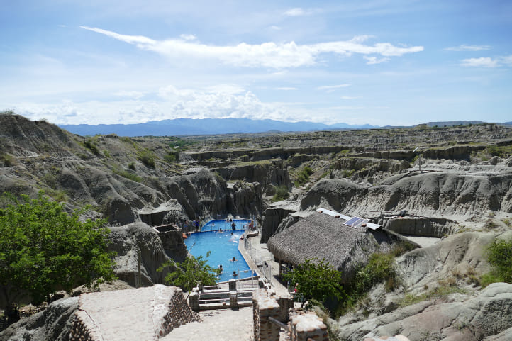
The Tatacoa Desert, Colombia’s second-largest arid zone, is a top ecotourism destination. Despite its name, it’s a tropical dry forest, not a traditional desert. Home to diverse wildlife like snakes, lizards, and ocelots, it also features unique plant life such as cacti.
The landscape offers dry canyons and rock formations, perfect for hiking and stargazing. Popular spots include La Culebra Canyon, Xilópalos Valley, Los Hoyos, El Cuzco Marciano, and a natural pool, with various trails to explore.
To get there, head to Villavieja, a 1-hour drive from Neiva, approximately 6 km (3 miles). Public transportation is an option. Stock up on supplies in Villavieja, but bringing pets unaccustomed to the cold is not recommended.
Price: Entry to the desert is free, but camping has a cost.
Website: http://www.colparques.net/TATACOA
Hiking in the Cuzco Labyrinth
Difficulty Level: Moderate
The terrain is rocky, but there are no significant ascents. The temperature on this trail can be intense, so staying hydrated is crucial.
One-way distance: 1.6 km (0.9 miles)
One-way duration: 1 hour
Climate: Warm arid
From Villavieja’s main square, take a moto-taxi or drive to the Tatacoa Desert. It’s about 20 minutes to the entrance of the Cuzco Labyrinth trail at Tatacoa Estadero.
Follow the marked route, descending to the red desert. Avoid climbing on stone and earth formations. Midway, navigate through earth mounds resembling a labyrinth.
Pass a section with vegetation and climb stairs for a stunning view. The endpoint is the Cuzco Labyrinth hostel on the main road, allowing you to return either by road or by retracing your trail
Los Hoyos Trail
Difficulty Level: Moderate
The terrain is rocky, but there are no significant ascents. The temperature on this trail can be intense, so staying hydrated is crucial.
One-way distance: 1.97 km (1 mile)
One-way duration: 2 hours
Climate: Warm arid
To reach the Los Hoyos trail entrance, you can drive from Villavieja, covering 16 km (9 miles) in approximately 35 minutes. If you’re near the Tatacoa Estadero, it takes 20 minutes by car to reach the Los Hoyos Estadero.
The trail entrance is located in front of this estadero. Along this route through the gray desert, you’ll pass through the following points in order:
- Salto del Manatial
- Salto Matamochos
- Relicto de bosque seco tropical
- Vista panorámica
- Congreso de los fantasmas
- Torres gemelas
- Piscina Los Hoyos
- Parqueadero Los Hoyos.
This trail is ideal for bird watching, observing fossils, and various stone formations.
Upon completing the trail, you’ll return to the Los Hoyos Estadero.
Important
This area has dangerous animals, so if you plan to camp, it’s recommended to go with a guide who can identify these species and act in case of an emergency.
Payments are only accepted in cash, as cards or electronic means are not supported.
Claro is the only mobile operator with signal coverage in this area.
It’s advised to undertake the routes before 12:00 pm.
Use insect repellent, and for camping, consider bringing items such as:
- Tent with sleeping bags
- Mosquito protective fabric
- External batteries
- Toiletries
- Water and food
- First aid kit.
Hiking Routes in Tesalia, Huila
Tesalia is a municipality located 98 km (60 miles) southwest of Neiva, taking approximately 2 hours by car. It is characterized by natural landscapes and abundant biodiversity.
Considered an ideal destination for ecotourism lovers, Tesalia offers various natural reserves where activities like hiking, bird watching, and boat trips can be enjoyed.
Hiking in the Simio Canyon
Difficulty Level: Difficult
The terrain is flooded and rocky, with several narrow trail ascents. Therefore, a good physical condition is required.
One-way distance: 3.5 km (2 miles)
One-way duration: 2 hours and 30 minutes
Climate: Temperate
Head to Raspayuco neighborhood, 8 km from Tesalia. Drive 30 minutes to El Cajón farm, an entry to the canyon. Follow the route along El Guayabito stream, hiking to the canyon and then engaging in canyoning.
Admire the waterfall, explore remnants of miners’ stones, pass Elf’s Cave and the narrowest part.
Enjoy the beautiful environment, capturing photos of birds.
Return the same way, noting there’s another access through the cave’s back, but it’s unmarked.
Important
Due to a waterfall, some areas are flooded, with water reaching up to the abdomen in certain parts.
Bring a change of clothes and waterproof footwear.
This site is private.
Pets are not allowed.
Price: There is an entry fee that includes insurance, a guide, and refreshments.
Hiking Routes in Gigante, Huila
Gigante is a significant municipality in Huila, located 86 km (53 miles) south of Neiva, about a 2-hour drive. Its altitude varies from 300 to 2,600 meters (984 to 8,530 feet) above sea level, resulting in diverse climates and ecosystems.
This municipality boasts abundant forests and water sources, making it an intriguing ecotourism destination.
Hike to La Mano del Gigante Viewpoint
Difficulty Level: Difficult
The terrain is steep and humid, featuring many stairs, and it can get quite hot.
One-way Distance: 2 km (1.5 miles)
One-way Duration: 50 minutes
Climate: Tropical warm
The viewpoint, a 20-minute drive from Gigante, is reached by a 4 km path. Use a taxi or public transport due to the narrow road. With a high-traction vehicle, you can drive. Ascend the mountain trail for 50 minutes on an unpaved path, crossing rocky areas, streams, and stairs. The route showcases wildlife and vegetation.
At the summit, find tourist spots with hammocks and La Mano del Gigante, a 5-meter wooden structure offering views of Gigante and Betania Reservoir. Return the same way or hire a vehicle for convenience.
Important
Pets are allowed.
It’s recommended to undertake this hike before 12:00 pm.
Operating hours: Everyday from 6:00 am to 6:00 pm.
Price: entry to the site has a cost.
Hiking Routes in Isnos, Huila
Isnos is a picturesque municipality located 228 km (141 miles) from Neiva, taking almost 5 hours by car, with an altitude of 1,774 meters (5,820 feet) above sea level. Famous for its invaluable pre-Columbian sculptures, Isnos offers hiking and wildlife observation in mountainous and aquatic environments.
Hike to the Lower Part of Salto de Bordones
Difficulty Level: Medium
The terrain is steep, muddy, without railings or ropes for support, requiring careful footing.
One-way Distance: 1 km (0.6 miles)
One-way Duration: 1 hour
Climate: Temperate
Salto de Bordones, a waterfall with a 400-meter drop, can be explored via an ecological trail on the Salto de Bordones – La Laguna route in Isnos. Though not challenging to reach, limited signage suggests asking locals for directions.
Start by driving 40 minutes to Salto de Bordones, about 12 km from Isnos. Follow signs to the trail entrance, where locals can guide you to the waterfall.
The trail, about 10 minutes in, splits into paths leading to the top and lower parts. The descent to the lower part is steep, covering 1 km in approximately 1 hour. It’s humid with lush vegetation, maintaining a cool temperature.
Arrive at a cliff facing the waterfall for a marvelous panoramic view. Rainbows are common in this area. Return using the same route.
Important
There are two trails ascending to the top of the waterfall, but they are deteriorated. This route is recommended.
Pets are not recommended.
For first-timers, hiring a guide is helpful.
Carry sufficient water and snacks.
Wear waterproof and gripping footwear.
Other Noteworthy Hiking Routes in Huila, Colombia
Huila features diverse parks and nature reserves. Two notable ones are the Nevado del Huila National Natural Park and the Puracé National Natural Park, renowned for their biodiversity, ecological significance, and hiking-related ecotourism services.
Unfortunately, they are currently closed due to the ecosystem’s fragility and public risks associated with volcanic activity in Nevado del Huila, an active volcano. The reopening date is unspecified, so it’s advisable to check the official National Parks page before planning your trip.
Climatic Conditions in Huila, Colombia
The average climate in Huila is warm and cloudy. However, due to its geographical position and topography, there are numerous variations based on altitude above sea level.
There are four predominant climates in the Huila department:
- Tropical Warm Climate (24°C to 32°C / 75°F to 89°F): Hot and usually humid throughout the year, with cool nights. Common in Neiva, at 442 meters (1,450 feet) above sea level.
- Arid Warm Climate (exceeding 30°C / 86°F): Extremely hot, completely dry, and chilly nights. Typical in the Tatacoa Desert, at an altitude of 386 to 486 meters (1,266 to 1,594 feet) above sea level.
- Humid Temperate Climate (18°C to 25°C / 64°F to 77°F): Intermediate temperatures, windy, and regular rainfall. Seen in Pitalito, situated at 1,318 meters (4,324 feet) above sea level.
- Páramo Climate (5°C to 15°C / 41°F to 59°F): Due to the high altitudes of páramos like Miraflores, ranging from 3,300 to 3,470 meters (10,862 to 11,384 feet) above sea level, the climate is extreme. It is cold during the day, foggy, rainy, and experiences frost at night.
Rainy Seasons in Huila, Colombia
Rainy periods occur in April, May, and from October to December, with annual precipitation ranging from 1,000 to 2,500 millimeters (39.37 to 98.452 inches). For hiking, it’s advisable to go from January to March and from June to September.
Recommendations for Hiking in Huila
Follow the rules of each location, typically set by governmental entities aiming to preserve specific ecosystems. Common guidelines include:
- Do not litter.
- Do not disturb animals in their habitats.
- Do not cut or uproot plants.
- No smoking.
- No hunting.
- Do not bring pets to protected areas unless clearly allowed.
- Do not throw anything into water sources.
- Avoid making fires in unauthorized areas.
- Do not take shortcuts or walk in prohibited zones.
- Do not consume alcoholic beverages or psychoactive substances.
- Avoid hiking in dangerous weather conditions.
- Do not camp where not allowed.
- Do not play music with speakers.
Additionally, these tips can help you avoid complications:
- Plan your route in advance.
- Be cautious with online reservations; sometimes, they can be scams.
- Seek information on official and governmental websites, often available in English.
- Hire a reliable guide with a national guide card.
- If you have health issues, inform your companions.
What to Bring for Hiking in Huila
Hiking requires some preparation and equipment. Here are suggestions for what to bring:
- A lightweight backpack
- Hiking poles
- Comfortable and weather-appropriate clothing and footwear
- Identification documents
- Water and snacks
- A whistle
- A first aid kit
- Sunscreen and a hat
- Personal medications
- Change of clothes and waterproof footwear
- Local currency in cash.
Feel free to contact us, and we’ll be more than happy to assist you in your new adventure. Until next time, traveler!
More Nature Tourism Experiences in Colombia
Here is a list of incredible destinations for hiking and other nature activities in Colombia:
- The Best Hiking Routes in Colombia.
- The Most Representative Flowers in Colombia.
- Cacao Guide in Colombia.
More recommended hiking trails
- Discover the 7 Best Hiking Routes in Antioquia, Colombia
- The 9 Best Hiking Routes in Cundinamarca, Colombia
- Must-Try Hiking Trails in Magdalena, Colombia
- Discover 4 Must-Visit Hiking Trails in Amazonas, Colombia
- Explore 9 Scenic Trails in Eastern Plains, Colombia
- 5 Must-Experience Hiking Trails in Valle del Cauca, Colombia
- 6 Must-Experience Hiking Trails in Cauca, Colombia
- 5 Must-Experience Hiking Routes in Huila, Colombia
- The 6 Best Hiking Trails in Tolima, Colombia
- The 7 Most Incredible Hiking Routes in Boyacá, Colombia
- Hiking in Santander, Colombia – 5 Incredible Routes
- Hiking in Colombia’s Coffee Region: Top 5 Must-Visit Routes
